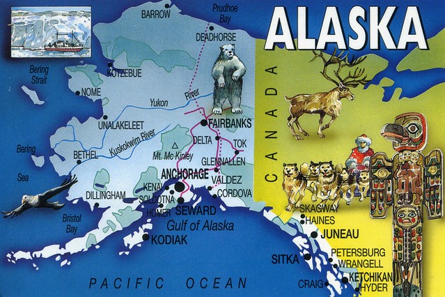
Alaska is the largest state of the United States by area; it is situated in the northwest extremity of the North American continent, with Canada to the east, the Arctic Ocean to the north, and the Pacific Ocean to the west and south, with Russia further west across the Bering Strait. Approximately half of Alaska's 698,473 residents live within the Anchorage metropolitan area. As of 2009, Alaska remains the least densely populated state of the U.S.

The second card shows Juneau, the state capital of Alaska.
The area of Juneau is larger than that of Rhode Island and Delaware individually and almost as large as the two states combined. Downtown Juneau is nestled at the base of Mount Juneau and across the channel from Douglas Island. As of the 2000 census, the City and Borough had a population of 30,711. The U.S. Census Bureau's 2008 population estimate for the City and Borough was 30,988.
Interesting fact that Amy told me of Juneau: You can only get to and from Juneau by boat or airplane. It's the only US state capital that isn't connected to anywhere else by road.

The stamps are all definitives. The flag with the Statue of Liberty doesn't need any explanation, I believe, but I'm not sure what the animal is...


 Maroon


")


No comments:
Post a Comment