Last week I posted about a gorgeous postcard from Dominica I received from Gilles of Belgium. Well, not only did he make me very happy with that particular postcard, but he also surprised me with one from Antigua - another new country to my collection! Some people really are so kind. Thanks a million again, Gilles!
English Harbour, so named because it was the Caribbean base of the British Navy in the 18th century. Admiral Nelson chose it because of its "hurricane-proof" inner harbour and the commanding view of its approaches from Shirley Heights where this picture was taken.
Antigua is an island in the West Indies, in the Leeward Islands in the Caribbean region, the main island of the country of Antigua and Barbuda. Antigua means "ancient" in Spanish and was named by Christopher Columbus after an icon in Seville Cathedral, Santa Maria de la Antigua — St. Mary of the Old Cathedral. The island's circumference is roughly 87 km and its area 281 km2. Its population was 80,161 (at the 2011 Census). The economy is mainly reliant on tourism, with the agricultural sector serving the domestic market.
Over 31,000 people live in the capital city, St. John's. The capital is situated in the north-west and has a deep harbour which is able to accommodate large cruise ships. Other leading population settlements are All Saints (3,412) and Liberta (2,239), according to the 2001 census.
Thursday 31 May 2012
Orchid, Venezuela
Let's stay in South America for now.. moving up further north, this postcard is one of the few cards I have received from Venezuela. Orchid is the national flower and natural emblem of Venezuela and the one here looks particularly beautiful (purple is one of my favourite colours, too!).
The Orchidaceae or orchid family is a diverse and widespread family of flowering plants with colorful and fragrant blooms. Along with the Asteraceae, it is one of the two largest families of flowering plants, with between 21,950 and 26,049 currently accepted species, found in 880 genera. Selecting which of the two families is larger remains elusive because of the difficulties associated with putting hard species numbers on such enormous groups. Regardless, the number of orchid species equals more than twice the number of bird species, and about four times the number of mammal species. It also encompasses about 6–11% of all seed plants. The largest genera are Bulbophyllum (2,000 species), Epidendrum (1,500 species), Dendrobium (1,400 species) and Pleurothallis (1,000 species).
The family also includes Vanilla (the genus of the vanilla plant), Orchis (type genus), and many commonly cultivated plants such as Phalaenopsis and Cattleya (the one shown here, unless I'm very much mistaken). Moreover, since the introduction of tropical species in the 19th century, horticulturists have produced more than 100,000 hybrids and cultivars.
Trujillo, Peru
This is one of the beautiful postcards of Peru I received from a swap with the lovely Jane last year. I have a thing for pretty windows and doors and little details so posting this card here at some point was a pretty obvious choice. It all looks so pretty!
Trujillo, in northwestern Peru, is the capital of the La Libertad Region. The city is located on the banks of the Moche River, near its mouth at the Pacific Ocean, in a valley of great cultural hegemony with Moche and Chimu cultures at its respective time.
Trujillo was honored in 1822 by the congress of republic with the title "Meritorious City and Faithful to the Fatherland", for its role in the fight for independence. Trujillo is the birthplace of Peru's judiciary, and it was twice designated as the capital of the country. It was the scene of the Revolution of Trujillo in 1932.
In Trujillo, the birthplace of Liberty, was born on the Judiciary, and the judges took their historic responsibility to ensure the weapons of law: freedom and rights of the people freed from political and military power, normative and ideological of state Spanish The city is also considered the cradle of liberty and cradle of the judiciary in Peru.
Trujillo is known as the "Capital of the everlasting Spring", is considered the "Capital of the Marinera," which is a typical dance in Peru, "Cradle of the typical Peruvian Paso Horse" well as the "Capital of Culture of Peru". It has sponsored numerous national and international cultural events, and has a lively arts community. Current festivals include the "Marinera National Festival", the "Spring International Festival" and the "International Book Fair", which is one of the most important cultural events in the country.
Trujillo is close to two major archeological sites of pre-Columbian monuments: Chan Chan, the largest adobe city in the ancient world, designated a World Heritage Site by UNESCO in 1986; and the temples of the Sun (the largest adobe pyramid in Peru) and Moon.
The city centre contains many examples of colonial and religious architecture incorporating distinctive wrought ironwork. It includes residential areas, a central business district and industrial supply distribution to the various districts. The Roman Catholic Archdiocese of Trujillo has its seat here. Catholicism still dominates and 10 colonial churches remain inside Avenida Espana, with those of Huaman, Huanchaco and Moche within 15 kilometres of Trujillo's centre.
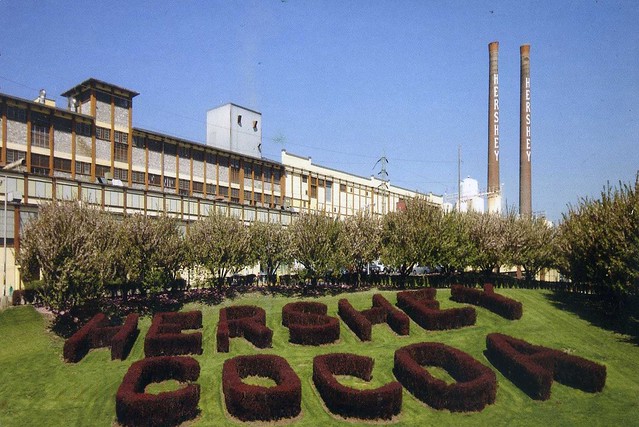
Hershey, PA, USA
My Canadian pal Christine visited Hershey, USA earlier this year and surprised me with this great postcard from there.
Hershey is a census-designated place (CDP) in Derry Township, Dauphin County in the Commonwealth of Pennsylvania. Hershey's chocolates are made in Hershey, Pennsylvania. The community is located 14 miles east of Harrisburg and is part of the Harrisburg–Carlisle Metropolitan Statistical Area. Hershey has no legal status as an incorporated municipality and all municipal services are provided by Derry Township. The population was 12,569 at the 2000 census. It is popularly called "Chocolatetown, USA." Hershey is also referred to as "The Sweetest Place on Earth."
The community is home to The Hershey Company which also makes the well-known Hershey Bar and Hershey's Kisses, as well as the parent to the H. B. Reese Candy Company, manufacturer of Reese's Peanut Butter Cups. Hershey's Chocolate World is a factory store and virtual tour ride of The Hershey Company. Hershey Entertainment and Resorts Company owns and operates Hersheypark, Hersheypark Stadium and other attractions such as ZooAmerica, Hershey Gardens, and is a major employer of the community and surrounding area.
Random fact of the day: Mr. Hershey originally had a ticket for the Titanic's maiden voyage.
Zhouzhuang, China
This is one of the MANY treats I've received from the wonderful 'Choose a Country' RR on the PC forum. China sure is full of beautiful places!
Zhouzhuang is a town in Jiangsu province, China. It is located within Kunshan county-level city, 30 km southeast of Suzhou. Zhouzhuang is a popular tourist destination, classified as a AAAAA scenic area by the China National Tourism Administration. It is one of the most famous water townships in China, noted for its profound cultural background, the well preserved ancient residential houses and the elegant watery views. It has been called the "Venice of the East".
This card shows the Fuan Bridge. Located at the eastern end of Zhongshi Jie, Fuan Bridge was built in 1355 during the Yuan Dynasty. The unique trait of the Fuan is the consummate combination of the single-arch bridge and the bridge towers.
Belgrade, Serbia
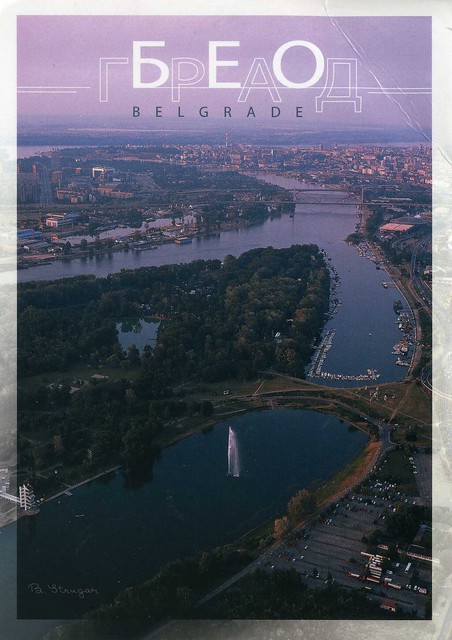
Ana surprised me with this gorgeous, HUGE postcard from the 1st Postcrossing meeting in Belgrade on 29 October last year. It's always great to receive cards from Postcrossing meet-ups, and it's even more special when they were sent by a dear person. :) I'd love to attend more meet-ups but there aren't many in the UK, and even then it's the case of whether of not I can afford to go, grrr.
On this card you can see Ada Ciganlija, an island on the Sava which was turned into a peninsula by an artificial isthmus. On the lake there is a bathing resort, and on the river banks there are rowing clubs, swimming clubs, boat marines and several hundreds of boat houses.
It looks really beautiful, and I love the purple tones of this card, SO pretty!
Saturday 26 May 2012
Dominica
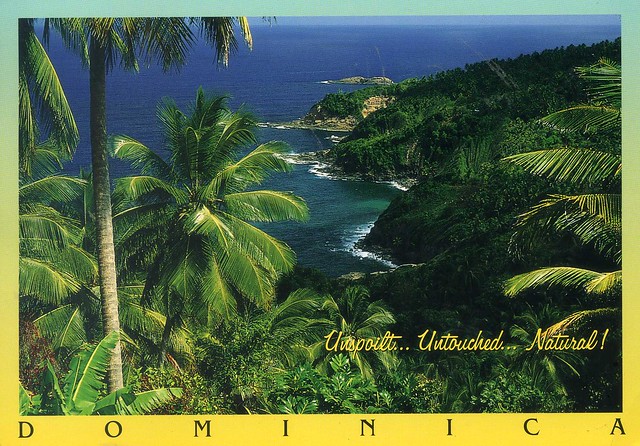
Today's last card is a real treat. Dominica is one of those countries I barely even know of before I joined Postcrossing, and I never thought I'd ever be lucky enough to actually receive a postcard from there. ...but I was, earlier this year! Gilles of Belgium is one lucky person, having been to so many exotic countries. I'd love to visit the Caribbean one day, too, and a place like the one on this postcard really does look like heaven on earth.
Dominica is an island nation in the Lesser Antilles region of the Caribbean Sea, south-southeast of Guadeloupe and northwest of Martinique. Its size is 750 square kilometres and the highest point in the country is Morne Diablotins, which has an elevation of 1,447 metres. The Commonwealth of Dominica had a population of 71,293 at the 2011 Census. The capital is Roseau.
Dominica has been nicknamed the "Nature Isle of the Caribbean" for its unspoiled natural beauty. It is the youngest island in the Lesser Antilles, still being formed by geothermal-volcanic activity, as evidenced by the world's second-largest hot spring, Boiling Lake. The island features lush mountainous rainforests, home of many rare plant, animal, and bird species. There are xeric areas in some of the western coastal regions, but heavy rainfall can be expected inland. The Sisserou Parrot (also known as the Imperial Amazon), the island's national bird, is featured on the national flag. Dominica's economy is heavily dependent on tourism, agriculture and heavy taxation.
Christopher Columbus named the island after the day of the week on which he spotted it, a Sunday (dominica in Latin), November 3, 1493. In the hundred years after Columbus's landing, Dominica remained isolated, and even more Caribs settled there after being driven from surrounding islands as European powers entered the region. France formally ceded possession of Dominica to Great Britain in 1763. Great Britain then established a colony on the island in 1805.
The emancipation of African slaves occurred throughout the British Empire in 1834, and, in 1838, Dominica became the first British Caribbean colony to have a legislature controlled by a black majority. In 1896, the United Kingdom reassumed governmental control of Dominica, turning it into a Crown colony. Half a century later, from 1958 to 1962, Dominica became a province of the short-lived West Indies Federation. In 1978, Dominica became an independent nation.
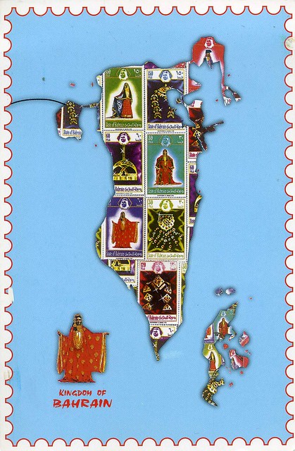
Kingdom of Bahrain
I don't have many postcards of (or from) Bahrain so when Gosia of Italy was offering some Bahrain map cards for swap last year, I just couldn't resist. ...and I love the pictures of stamps on this card! :)
Bahrain is a small island state near the western shores of the Persian Gulf. It is ruled by the Al Khalifa royal family. The population in 2010 stood at 1,234,571, including 666,172 non-nationals. Formerly an emirate, Bahrain was declared a kingdom in 2002.
Bahrain is an archipelago of 33 islands, the largest being Bahrain Island, at 55 km long by 18 km wide. Saudi Arabia lies to the west and is connected to Bahrain by the King Fahd Causeway. The peninsula of Qatar is to the southeast across the Gulf of Bahrain. The planned Qatar Bahrain Causeway will link Bahrain and Qatar and become the world's longest marine causeway.
Known for its oil and pearls, Bahrain is also home to many large structures, including the Bahrain World Trade Center and the Bahrain Financial Harbour, with a proposal in place to build the 1,022 m high Murjan Tower. The Qal'at al-Bahrain (the harbour and capital of the ancient land of Dilmun) was declared a UNESCO World Heritage Site in 2005. The Bahrain Formula One Grand Prix takes place at the Bahrain International Circuit.
Since 2011, the government of Bahrain has faced a series of massive demonstrations, amounting to a sustained campaign of civil unrest, also known as the 2011–2012 Bahraini uprising, and has faced widespread criticism for its crackdown on protestors which has resulted in thousands of casualties.
The postcard was mailed from Italy, hence the Italian stamp (which I really like, btw!).
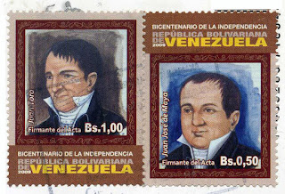
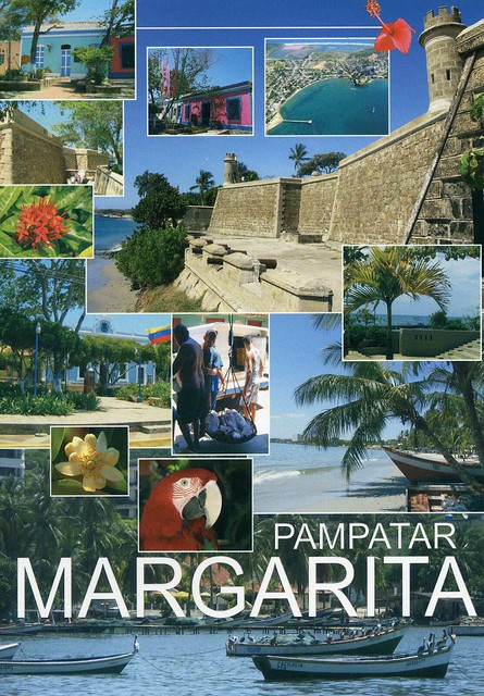
Pampatar, Isla de Margarita, Venezuela
A lovely postcard I received from dear Daniela last year. This is one of those few cases where I don't mind a card being a multiview - I really like all the little details here (even if it would be nice to see bigger pictures of the colourful houses...). ...and it's another seaside view! :D
Pampatar is a city on Isla Margarita, Nueva Esparta State, Venezuela. It is located in the Maneiro Municipality.
Pampatar lies 10 km northeast of Porlamar. It's a coastal town, founded in 1552. Its strategic importance becomes clear when visiting the Castillo de San Carlos de Borromeo on the waterfront in the center of town. Constructed entirely of coral, the fort, built by the Spanish in 1662 after the original was destroyed by the Dutch. In the center of town is the Iglesia Santísimo Cristo or Iglesia del Cristo del Buen viaje, which features a bell tower with an outside staircase — an architectural oddity found on several churches on Isla Margarita. Nowadays this town is very famous for its malls (Sambil or Rattan Plaza) and its commercial activity 24 hours a day.
Goli otok, Croatia
More seaside views... This time from Croatia, sent my the lovely Nives last year. Yeah, I'm really behind with this blog - I have TONS of postcards I want to post about here!
Goli otok is an island off the northern Adriatic coast, located between Rab's northeastern shore and the mainland, in what is today Croatia's Primorje-Gorski Kotar county. The island is barren and uninhabited. Its northern shore is almost completely bare, while the southern one has small amounts of vegetation as well as a number of coves.
Despite having long been an occasional grazing ground for local shepherds' flocks, the barren island was apparently never permanently settled other than during the 20th century. Throughout World War I, Austria-Hungary sent Russian prisoners of war from Eastern Front to Goli otok.
In 1949, the entire island was officially made into a high-security, top secret prison and labor camp run by the authorities of FPR Yugoslavia, together with the nearby Sveti Grgur island, which held a similar camp for female prisoners. Until 1956, throughout the Informbiro period, it was used to incarcerate political prisoners. These included known and alleged Stalinists, but also other Communist Party members or even nonparty citizens accused of exhibiting sympathy or leanings towards the Soviet Union. Many anticommunist (Serbian, Croatian, Macedonian, Albanian and other nationalists etc.) were also incarcerated on Goli Otok. Non-political prisoners were also sent to the island to serve out simple criminal sentences and some of them were sentenced to death. Numbers of total prisoners and massacred victims are unknown but Vladimir Dedijer estimates 32,000 male prisoners in Goli otok only; other historians estimates 4,000 killed.
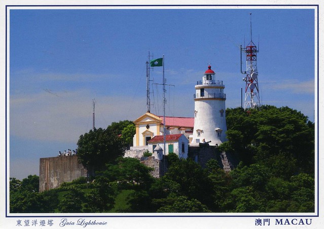
Guia Fortress, Macau
Another postcard from a friend.. My dear friend Miranda went back home to Hong Kong again recently and came back a couple of weeks ago. While she was away she also visited Macau, and brought me a gorgeous postcard pack of Macau. The cards are all amazing, I had a hard time picking just one to post about here. I chose this one as it's a slightly different view of Macau and I really like the colours here.
The Guia Fortress is a historical military fort, chapel, and lighthouse complex in the St. Lazarus Parish. The complex is a UNESCO World Heritage Site as part of the Historic Centre of Macau.
The fort and chapel were constructed between 1622 and 1638, after an unsuccessful attempt by the Netherlands to capture Macau from Portugal. The lighthouse was constructed between 1864 and 1865, the first western style lighthouse in east Asia or on the China coast. The lighthouse stands at 91 meters tall, and has a light visible for some 20 miles in clear weather conditions. The complex was built upon the highest point on Macau, Guia Hill, and named after the same location. Today, the site is a tourist destination.
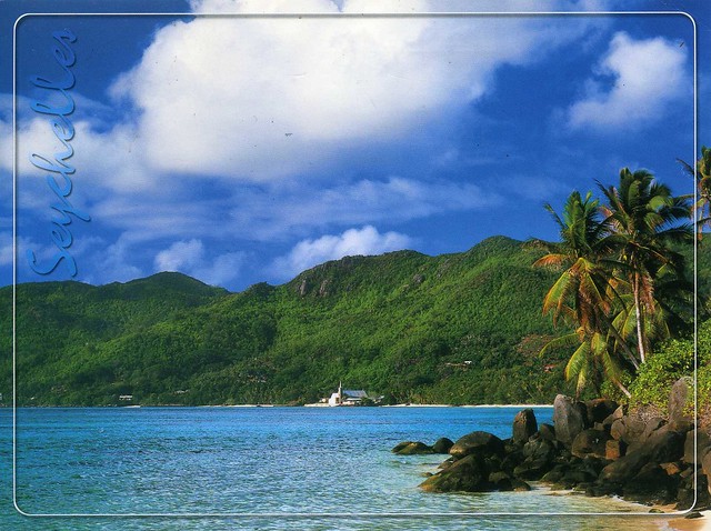
Seychelles
This week has been really sunny and warm, well over +20 C every day. It makes a nice change to the usual rain and cold, although the heat hasn't been much fun during Aikido lessons (there's no air conditioning at the sports hall in the university where I practice). Otherwise I can't complain much. :) ...although at times like this I wish I lived closer to the sea and not in the middle of England, about as far from the seaside as you can get in this country. I'd love to go on a beach!
I wouldn't mind a beach like this either ;) It looks like such a perfect place, a tropical paradise. This beach is located in Anse Royale, an administrative district of Seychelles located on the island of Mahé. My penpal Sperenza sent me this card last year and it's my first written and stamped postcard from Seychelles. :)
I wouldn't mind a beach like this either ;) It looks like such a perfect place, a tropical paradise. This beach is located in Anse Royale, an administrative district of Seychelles located on the island of Mahé. My penpal Sperenza sent me this card last year and it's my first written and stamped postcard from Seychelles. :)
Wednesday 23 May 2012
Bangladesh
Just one more card for today.. I'll need to leave in about half an hour - I'll be meeting up with Matt after he finishes work and then the plan is to go to the cinema to see 'Dark Shadows' (I'm a bit worried as most of the reviews I've read about it haven't been very good, but I really love most Tim Burton films so I do have to give it a try at least!). Anyway.. this card is such a treat: my first ever written and stamped postcard from Bangladesh! I'd tried to arrange a swap from there before but that didn't work out. ..then earlier this year another opportunity arose and I just couldn't resist ;)
I really, really like this card. The place it depicts looks so peaceful and tranquil, and the yellow field looks so pretty.
Bangladesh is a sovereign state located in South Asia. It is bordered by India and Burma and by the Bay of Bengal to the south. The capital (and largest city) is Dhaka, located in central Bangladesh. The official state language is Bengali. The name Bangladesh means "Country of Bengal" in the official Bengali language.
The borders of present-day Bangladesh were established with the partition of Bengal during the reign and demise of the British India. Its map was chartered by Sir Cyril Radcliffe during the creation of Pakistan and India in 1947, when the region became East Pakistan, part of the newly formed nation of Pakistan. Due to political exclusion and economic exploitation by the politically dominant West Pakistan, popular agitation grew against West Pakistan and led to the Bangladesh Liberation War in 1971, after the Bangladeshi Declaration of Independence on 26 March 1971. With the direct and indirect help of India, 9 months of war came to an end on 16 December 1971 by the surrender of the Pakistan Army at Ramna Race Course, after 13 days of direct action by the Indian Army.
Bangladesh is a parliamentary democracy, with an elected parliament called the Jatiyo Sangshad. It is the eighth-most populous country and among the most densely populated countries in the world. Just like in the rest of South Asia the poverty rate prevails, although the United Nations has acclaimed Bangladesh for achieving tremendous progress in human development. Geographically, the country straddles the fertile Ganges-Brahmaputra Delta and is subject to annual monsoon floods and cyclones.
The country is listed among the Next Eleven economies. It is a founding member of the South Asian Association for Regional Cooperation, BCIM, the D-8 and BIMSTEC, and a member of the Commonwealth of Nations, the Organisation of Islamic Cooperation and the Non-Aligned Movement. However, Bangladesh continues to face a number of major challenges, including widespread political and bureaucratic corruption, widespread poverty, and an increasing danger of hydrologic shocks brought on by ecological vulnerability to climate change.
Sarawak, Malaysia
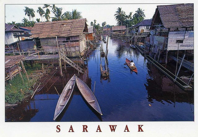
Ok, I got the idea from Ana - to have a specific thread on the Postcrossing forum to ask for swaps for postcards from my favourites. It's been so much fun (even if I was quite overwhelmed at first because SO many people offered to swap!) and I've received lots of beautiful postcards as a result. Why didn't I try that earlier?! :P Anyway, this is one of the cards I've received from that little 'project'; a lovely view from Malaysia. Thank you so much, Aileen!
On this card you can see a typical Melanau village at Kampung Tillian near Mukah. The Melanau, traditionally fishermen and sago growers, built their houses on or near rivers to allow easy access to the sea and effortless transport of sago logs.
Sarawak, then, is one of two Malaysian states on the island of Borneo. Known as Bumi Kenyalang ("Land of the Hornbills"), Sarawak is situated on the north-west of the island. It is the largest state in Malaysia followed by Sabah, the second largest state located to the north-east.
The administrative capital is Kuching, which has a population of 579,900. Major cities and towns include Miri (pop. 263,000), Sibu (pop. 254,000) and Bintulu (pop. 176,800). As of the last census (2010), the state population was 2,420,009. Sarawak has more than 40 sub-ethnic groups, each with its own distinct language, culture and lifestyle. Cities and larger towns are populated predominantly by Malays, Melanaus, Chinese, Indians and a smaller percentage of Ibans and Bidayuhs who have migrated from their home-villages for employment reasons. Generally, Sarawak has seven major ethnic groups namely Iban, Chinese, Malay, Bidayuh, Melanau, Orang Ulu and 'others'. Several more minor ethnics which do not belong to any of these seven major ethnic groups are Kedayan, Javanese, Bugis, Murut and Indian. Unlike Indonesia, the term Dayak is not officially used to address Sarawakian's native ethnicity.
Sarawak has an abundance of natural resources. LNG and petroleum have provided the mainstay of the Malaysia federal government's economy for decades while State of Sarawak only get a 5% royalty from it. Sarawak is also one of the world's largest exporters of tropical hardwood timber and is the major contributor to Malaysian exports.
Cantabria, Spain
A lovely map card I received from the wonderful 'Choose a Country' RR. (I've just hosted my own group in this RR as well, which has been fun as usual.) I just love these map cards with all the little details!
Cantabria is a Spanish historical region and autonomous community with Santander as its capital city. It is bordered on the east by the Basque Autonomous Community (province of Biscay), on the south by Castile and León (provinces of León, Palencia and Burgos), on the west by the Principality of Asturias, and on the north by the Cantabrian Sea (Bay of Biscay).
Cantabria belongs to Green Spain, the name given to the strip of land between the Bay of Biscay and the Cantabrian Mountains, so called because of its particularly lush vegetation, due to the wet and moderate oceanic climate. The climate is strongly influenced by Atlantic Ocean winds trapped by the mountains; the average precipitation is about 1,200 mm.
Cantabria is the richest region in the world for archaeological sites from the Upper Paleolithic period, although the first signs of human occupation date from Lower Paleolithic. The most significant site for cave paintings is that in the cave of Altamira, dating from about 16,000 to 9000 BC and declared, along with nine other Cantabrian caves, as World Heritage Sites by UNESCO.
The modern Province of Cantabria was constituted on 28 July 1778. The Organic Law of the Autonomy Statute of Cantabria was approved on 30 December 1981, giving the region its own institutions of self government.
Finland
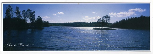
This blog turned two years last Thursday and I was going to write a special post about it, but then something happened and updating a postcard blog wasn't exactly one of my top priorities. I don't want to go into details here but I might be going to Finland at some point this summer. (Although mum did say that another option might be for her and dad to come over to England at some point, but nothing's quite sure at this point.)
Speaking of Finland, I've been receiving even more postcards from there than usual this month thanks to my dear friend Paula who deRRided to surprise me and asked for her cards in the Finnish 'May RR' to be sent to me instead as RAS cards. I'm still quite overwhelmed by her surprise, that was such a sweet thing to do! ...and the cards I've received have been amazing, so many lovely treats in my mailbox!
This is one of the cards I received from this RR. You can't really tell from the scan, but it's a huge panoramic card, SO pretty and really makes me miss Finland. My parents often spend their days off by a lake like this during summers and now that I live in England, I really love visiting the place again. I have no idea what lake the one on this card is as there's nothing about it anywhere on the card. They all look so similar (but beautiful!).
The stamp is so pretty as well! It shows the Bothnian Sea National Park in Finland. I'm so excited about the first day cancellation, too :)
Thursday 10 May 2012
Drakensberg, South Africa
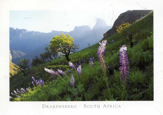
I only just realised that there aren't any postcards from South Africa in this blog. Ooops.. Maybe it's not so surprising, though, considering I only have a few postcards from there. ...which is why I was so excited earlier this year to find a swap offer, and I received this GORGEOUS postcard. It's such a treat!
The Drakensberg is the highest mountain range in Southern Africa, rising to 3,482 metres in height. In Zulu, it is referred to as uKhahlamba ("barrier of spears"). Its geological history lends it a distinctive character amongst the mountain ranges of the world. Geologically, the range resembles the Simien Mountains of Ethiopia. The Drakensberg mountain range is didived into three sections known as Northern, Central and Southern. This postcard is from the northern part and you can see the peak known as Monk's Cowl on the right hand side.
The Drakensberg Park has exceptional natural beauty in its soaring basaltic buttresses, incisive dramatic cutbacks, and golden sandstone ramparts. Rolling high altitude grasslands, the pristine steep-sided river valleys and rocky gorges also contribute to the beauty of the site. The site’s diversity of habitats protects a high level of endemic and globally threatened species, especially birds and plants. This spectacular natural site also contains many caves and rock-shelters with the largest and most concentrated group of paintings in Africa south of the Sahara, made by the San people over a period of 4,000 years. The rock paintings are outstanding in quality and diversity of subject and in their depiction of animals and human beings. They represent the spiritual life of the now extinct San people.
Chitwan National Park, Nepal
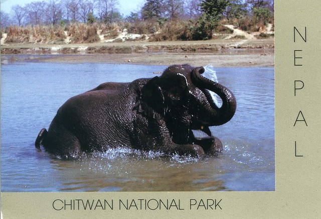
Something a little different now.. This is one of the only postcards of Nepal I have. Sadly it wasn't mailed directly from Nepal, but you can't have everything I suppose.. and the Slovenian stamps on this card are lovely!
Chitwan National Park is the first national park in Nepal. Formerly called Royal Chitwan National Park it was established in 1973 and granted the status of a World Heritage Site in 1984. It covers an area of 932 km2 and is located in the subtropical Inner Terai lowlands of south-central Nepal in the Chitwan District. In altitude it ranges from about 100 metres in the river valleys to 815 metres in the Churia Hills.
In the north and west of the protected area the Narayani-Rapti river system forms a natural boundary to human settlements. Adjacent to the east of Chitwan National Park is Parsa Wildlife Reserve, contiguous in the south is the Indian Tiger Reserve Valmiki National Park. The coherent protected area of 2,075 km2 represents the Tiger Conservation Unit (TCU) Chitwan-Parsa-Valmiki, which covers a 3,549 km2 huge block of alluvial grasslands and subtropical moist deciduous forests.
Montenegro
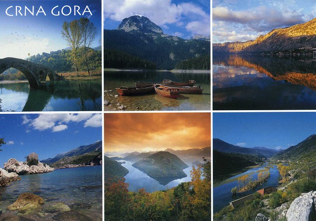
More natural beauty, this time from Montenegro. This is one of the many gorgeous postcards my dear Snježana sent me after visiting Montenegro last year. Thank you so much!! I have no idea what any of the places on this card are, but they are really beautiful nonetheless.
Montenegro is a country located in Southeastern Europe. It has a coast on the Adriatic Sea to the south-west and is bordered by Croatia to the west, Bosnia and Herzegovina to the northwest, Serbia to the northeast, Albania to the southeast, and Kosovo to the east. Its capital and largest city is Podgorica, while Cetinje is designated as the Prijestonica, meaning the former Royal Capital City.
From 1918, Montenegro was a part of Yugoslavia. On the basis of a referendum held on 21 May 2006, Montenegro declared independence on 3 June of that year.
Montenegro is classified by the World Bank as a middle-income country. Montenegro is a member of the UN, the World Trade Organization, the Organization for Security and Co-operation in Europe, the Council of Europe, the Central European Free Trade Agreement and a founding member of the Union for the Mediterranean. Montenegro is currently an official candidate for membership in the European Union and official candidate for membership in NATO.
Store Trolltind & Trollfjord, Norway
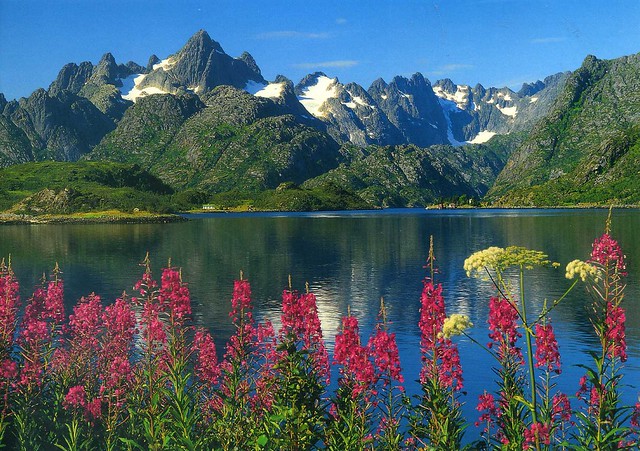
A GORGEOUS Norway view from a swap earlier this year. Thank you so much, Sissel, I absolutely adore this card!
Store Trolltind is the highest point along the Trolltindane ridge. It has the vertical Trollveggen cliff separating the peak from the Romsdalen valley below, a drop of about 1,700 metres which makes it the highest vertical cliff in Europe.
The Trollfjord (Trollfjorden) is a 2 km long sidearm of the Raftsund between the Norwegian archipelagos of Lofoten and Vesterålen. With its narrow entrance and steep-sided mountains, Trollfjord cuts westwards from the Raftsundet strait. The name is derived from troll, a figure from Norse mythology.
Aniva Lighthouse, Sakhalin, Russia
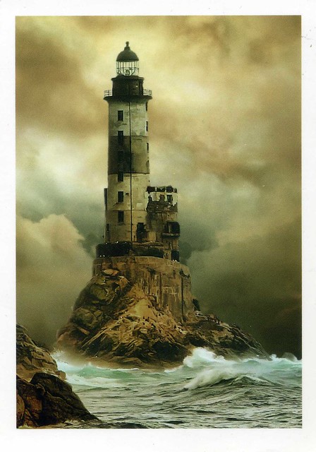
I've got a bit of a random mix for today, starting off with this great lighthouse postcard I received from a swap last year. I think it's my only postcard of Sakhalin, too.
According to the text on the back of this card, this is the Aniva Lighthouse in Sakhalin, by the Sea of Okhotsk. Sakhalin is a large island in the North Pacific, lying between 45°50' and 54°24' N. It is part of Russia, and is Russia's largest island, and is administered as part of Sakhalin Oblast. Sakhalin, which is about one fifth the size of Japan, is just off the east coast of Russia, and just north of Japan.
The indigenous peoples of the island are the Sakhalin Ainu, Oroks, and Nivkhs. Most Ainu relocated to Hokkaidō when the Japanese were displaced from the island in 1949.
Sakhalin was claimed by both Russia and Japan in the course of the 19th and 20th centuries, which led to bitter disputes between the two countries over control of the island.
The Sea of Okhotsk is a marginal sea of the western Pacific Ocean, lying between the Kamchatka Peninsula on the east, the Kuril Islands on the southeast, the island of Hokkaidō to the south, the island of Sakhalin along the west, and a long stretch of eastern Siberian coast (including the Shantar Islands) along the west and north. The northeast corner is Shelikhov Gulf. It is named after Okhotsk, the first Russian settlement in the Far East.
Wednesday 9 May 2012
Antigua Guatemala, Guatemala
One more card for today.. and it's a new country to my collection! I have admit I know hardly anything about Guatemala, but the place on this card at least looks really pretty. I love all the colourful buildings!
Antigua Guatemala (commonly referred to as just Antigua or la Antigua) is a city in the central highlands of Guatemala famous for its well-preserved Spanish Mudéjar-influenced Baroque architecture as well as a number of spectacular ruins of colonial churches. It has been designated a UNESCO World Heritage Site.
Antigua Guatemala serves as the municipal seat for the surrounding municipality of the same name. It also serves as the departmental capital of Sacatepéquez Department.
The city had a peak population of some 60,000 in the 1770s; the bulk of the population moved away in the late 18th century. Despite significant population growth in the late 20th century, the city had only reached half that number by the 1990s. According to the 2007 census, the city has some 34,685 inhabitants.
Guatemala, then, is a country in Central America bordered by Mexico to the north and west, the Pacific Ocean to the southwest, Belize to the northeast, the Caribbean to the east, and Honduras and El Salvador to the southeast. Its area is 108,890 km2with an estimated population of 13,276,517.
A representative democracy, its capital is Guatemala de la Asunción, also known as Guatemala City. Guatemala's abundance of biologically significant and unique ecosystems contributes to Mesoamerica's designation as a biodiversity hotspot. The former Mayan civilization was a Mesoamerican civilization, which continued throughout the Post-Classic period until the arrival of the Spanish. The Mayas live in Guatemala, Honduras, Belize, the southern part of Mexico and northern parts of El Salvador.
Guatemala became independent from Spain in 1821, joining the Mexican Empire. After it became an independent country in its own right, it was ruled by a series of dictators, assisted by the United Fruit Company. The late 20th century saw Guatemala embroiled in a 36-year-long civil war. Following the war, Guatemala has witnessed both economic growth and successful democratic elections. In the most recent election, held in 2011, Otto Pérez Molina of the Patriotic Party, won the presidency.
Betina, Croatia
Another seaside view, this time from Croatia. Thank you so much Agi for this treat! :) I'd love to spend a holiday in a place like this, mmmm...!
Betina is a village located on the Croatian island of Murter, seven km from Tisno, where a drawbridge connects the island and the mainland. The largest of the Šibenik archipelago islands, and the closest to the mainland, it has been populated since the time of the Illyrians (tribe of Liburns). Remains of the Roman settlement of Colentum as well as many ruins of Roman villas, murals, and mosaic testify to its occupation during the period of the Roman Empire.
Betina is a village located on the Croatian island of Murter, seven km from Tisno, where a drawbridge connects the island and the mainland. The largest of the Šibenik archipelago islands, and the closest to the mainland, it has been populated since the time of the Illyrians (tribe of Liburns). Remains of the Roman settlement of Colentum as well as many ruins of Roman villas, murals, and mosaic testify to its occupation during the period of the Roman Empire.
Eckerö, Åland
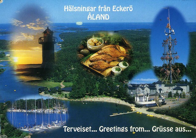
Another postcard with a lighthouse on it... This one is from MrsTaavi, who visited Finland and a few neighbouring countries last week. I wasn't sure which country she'd send a card from so I was really excited when she picked Åland :)
Eckerö is a municipality of Åland, with a population of 978 (31 January 2012) and covers an area of 752.63 square kilometres of which 644.94 km2 is water. The municipality is unilingually Swedish and 90% of the population are Swedish speakers. It is the westernmost municipality of Åland and Finland. The company Eckerö Linjen operates a ferry connection between Berghamn in Storby, Eckerö and Grisslehamn on Väddö, Norrtälje in Sweden.
The municipality has previously also been known as Ekkerö in Finnish documents, but is today referred to as "Eckerö" also in Finnish.
Eckerö's most famous building is the Post and Customs house. It is the largest and most impressive building that has been erected to aid the postal services between Stockholm and St. Petersburg. The building was built during the Russian times in 1828 and architect C.L Engel made the construction plans.
Labels:
2011,
åland,
cancellations,
eckerö,
food and drinks,
lighthouses,
RR
A lighthouse in Brittany, France
A lovely lighthouse postcard I received as an RAS card last year. I have no idea what this lighthouse is called or where exactly it's located, the postcard only says it's somewhere in Brittany. Heh, and like the sender, Erin, so do I wonder how this kind of photos are taken. The photographer must have a really good zoom in their camera!
Brittany (Bretagne in French) is a cultural region in the north-west of France. Previously a kingdom and then a duchy, Brittany was united to the Kingdom of France in 1532 as a province. Brittany has also been referred to as Less, Lesser or Little Britain (as opposed to Great Britain). Brittany is considered as one of the six Celtic nations.
Brittany occupies the northwest peninsula of continental Europe in northwest France. It is bordered by the English Channel to the north, the Celtic Sea and the Atlantic Ocean to the west, and the Bay of Biscay to the south. Its land area is 34,023 km². The historical province of Brittany is divided into five departments: Finistère in the west, Côtes-d'Armor in the north, Ille-et-Vilaine in the north east, Loire-Atlantique in the south east and Morbihan in the south on the Bay of Biscay.
In 1956, French regions were created by gathering departments between them. The Region of Brittany comprises, since then, four of the five Breton departments (80% of historical Brittany), while the remaining area of the old Brittany, the Loire-Atlantique department, around Nantes, forms part of the Pays de la Loire region. This territorial organisation is regularly contested. The Kingdom and the Duchy of Brittany, the province of Brittany, and the modern Region of Brittany cover the Western part of Armorica, as it was known during the period of Roman occupation.
In January 2007 the population of historic Brittany was estimated to be 4,365,500. Of these, 71% lived in the region of Brittany, while 29% lived in the region of Pays-de-la-Loire. At the 1999 census, the largest metropolitan areas were Nantes (711,120 inhabitants), Rennes (521,188 inhabitants), and Brest (303,484 inhabitants).
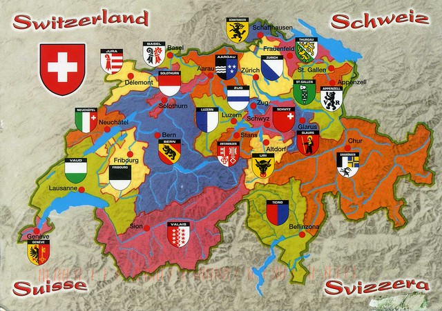
map of Switzerland
I haven't posted a card from Switzerland here for a while so here's one, a great map card I received from Andy (who runs the fab 'I'm going to vacation RR' on the Postcrossing forum).
Switzerland is a federal republic consisting of 26 cantons, with Bern as the seat of the federal authorities. Switzerland is a landlocked country geographically divided between the Alps, the Swiss Plateau and the Jura, spanning an area of 41,285 km2. While the Alps occupy the greater part of the territory, the Swiss population of approximately 8 million people is concentrated mostly on the Plateau, where the largest cities are to be found. Among them are the two global cities and economic centres of Zurich and Geneva.
The Swiss Confederation has a long history of armed neutrality—it has not been in a state of war internationally since 1815—and did not join the United Nations until 2002. It pursues, however, an active foreign policy and is frequently involved in peace-building processes around the world. Switzerland is also the birthplace of the Red Cross and home to a large number of international organizations, including the second largest UN office. On the European level, it is a founding member of the European Free Trade Association and is part of the Schengen Area – although it is notably not a member of the European Union, nor the European Economic Area.
Switzerland comprises three main linguistic and cultural regions: German, French, and Italian, to which the Romansh-speaking valleys are added. The Swiss, therefore, though predominantly German-speaking, do not form a nation in the sense of a common ethnic or linguistic identity. The strong sense of belonging to the country is founded on the common historical background, shared values (federalism and direct democracy) and Alpine symbolism. The establishment of the Swiss Confederation is traditionally dated to 1 August 1291; Swiss National Day is celebrated on the anniversary.
Himeji Castle, Japan
Uh-oh... It's been a while since my last post here, hadn't realised it was quite this long. Days just seem to have disappeared somewhere. ...and the new update page on blogger is really confusing, it could take me a while to get used to this... :S
This postcard is from my penpal Asuka in Japan. She actually sent this to me last October and I only just realised I haven't written to her for a while. I'm such a crappy penpal sometimes :S I sent her a postcard, I hope she'll still want to stay in touch. Anyway, she moved to Himeji last year. Himeji Castle is probably the most famous sight there. I love this slighly more unusual view of it.
Himeji Castle is a hilltop Japanese castle complex located in Himeji, in the Hyōgo Prefecture. The castle is regarded as the finest surviving example of prototypical Japanese castle architecture, comprising a network of 83 buildings with advanced defensive systems from the feudal period. The castle is frequently known as Hakuro-jō ("White Egret Castle") or Shirasagi-jō ("White Heron Castle") because of its brilliant white exterior and supposed resemblance to a bird taking flight.
Himeji Castle dates to 1333, when Akamatsu Norimura built a fort on top of Himeyama hill. The fort was dismantled and rebuilt as Himeyama Castle in 1346, and then remodeled into Himeji Castle two centuries later. Himeji Castle was then significantly remodeled in 1581 by Toyotomi Hideyoshi, who added a three-story castle keep. In 1600, Tokugawa Ieyasu awarded the castle to Ikeda Terumasa for his help in the Battle of Sekigahara, and Ikeda completely rebuilt the castle from 1601 to 1609, expanding it into a large castle complex. Several buildings were later added to the castle complex by Honda Tadamasa from 1617 to 1618. For over 400 years, Himeji Castle has remained intact, even throughout the extensive bombing of Himeji in World War II, and natural disasters such as the 1995 Great Hanshin earthquake.
Himeji Castle is the largest and most visited castle in Japan, and it was registered in 1993 as one of the first UNESCO World Heritage Sites in the country. The area within the middle moat of the castle complex is a designated Special Historic Site and five structures of the castle are also designated National Treasures. Along with Matsumoto Castle and Kumamoto Castle, Himeji Castle is considered one of Japan's three premier castles. In order to preserve the castle buildings, it is currently undergoing restoration work that is expected to continue for several years.
Subscribe to:
Posts (Atom)
























 Maroon


