Showing posts with label 2014. Show all posts

Saturday, 26 March 2016

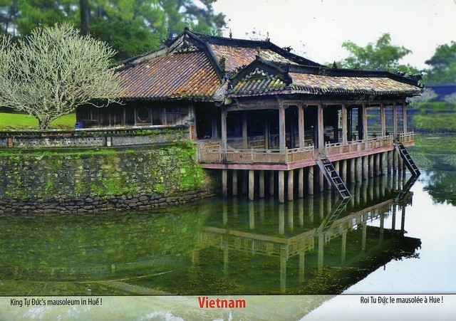
Complex of Hué Monuments, Vietnam

A lovely Unesco card from Vietnam I received a couple of years ago.


The Complex of Hue Monuments is located in and around Hue City in Thua Thien-Hue Province in the geographical centre of Vietnam and with easy access to the sea. Established as the capital of unified Vietnam in 1802 CE, Hue was not only the political but also the cultural and religious centre under the Nguyen Dynasty, the last royal dynasty of Vietnamese history, from 1802 to 1945 CE.

The plan of the new capital is in accordance with ancient oriental philosophy, and respected the physical conditions of the site.

The Ngu Binh Mountain (known as the Royal Screen) and the Perfume River, which runs through the city, give this unique feudal capital an entire setting of great natural beauty as well defining its symbolic importance. The site was chosen for a combination of natural features – hills representing a protective screen in front of the monuments or taking the role of “a blue dragon” to the left and “a white tiger” to the right – which shield the main entrance and prevent the entry of malevolent spirits. Within this landscape, the main features of the city are laid out.

The structures of the Complex of Hue Monuments are carefully placed within the natural setting of the site and aligned cosmologically with the Five Cardinal Points (centre, west, east, north, south), the Five Elements (earth, metal, wood, water, fire), and the Five Colours (yellow, white, blue, black, red).

Tuesday, 19 January 2016

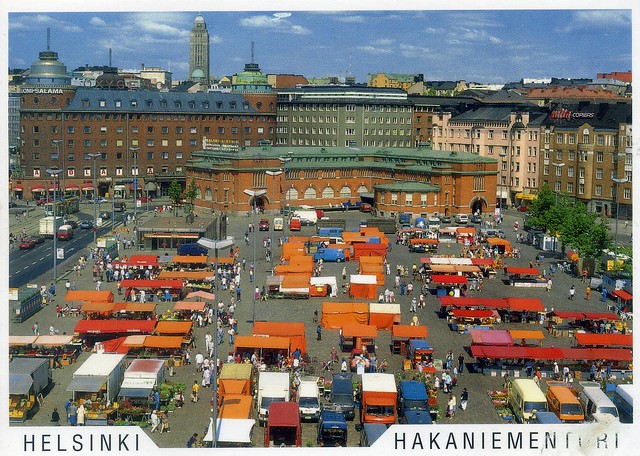
Hakaniementori, Helsinki, Finland

Ahhhh, Helsinki! I was there last month and walked past this place as well as my sister lives only a short walk away. It's such a nice area and I love the marketplace and the market hall. I was there in November last year as well and had yummy lentil soup in the soup kitchen in the market hall. :) I highly recommend 'Soppakeittiö'. :)


Hakaniemi is an unofficial district of Helsinki, the Finnish capital. It covers most of the neighbourhood of Siltasaari. It is considered a part of the Helsinki city center. Historically, it was often associated with the working class and worker's associations. However, the cost of living has risen considerably in recent years and is now on par with the rest of the downtown area of Helsinki. The best-known features of Hakaniemi include a large and lively marketplace, Oriental food stores with a good variety of Asian imported products the headquarters of several trade unions, the headquarters of the Social Democratic Party of Finland and the Left Alliance Party and the Helsinki Hilton hotel. Famous buildings include the Ympyrätalo building (architects Heikki and Kaija Sirén, 1968) and the Hakaniemi Market Hall (architect Karl Hård af Segerstad, 1914).

Hakaniemi square has been built on reclaimed land. It has been site of farmers' market since 1897.

Saturday, 9 May 2015

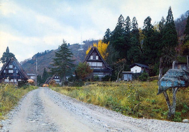
Historic Villages of Shirakawa-go and Gokayama

A lovely Unesco card from Japan. ...and with a Year of the Sheep stamp and a special cancellation! :)


This is Ainokura Village, one of the Historic Villages of Shirakawa-go and Gokayama in Japan. Located in a mountainous region that was cut off from the rest of the world for a long period of time, these villages with their Gassho-style houses subsisted on the cultivation of mulberry trees and the rearing of silkworms. The large houses with their steeply pitched thatched roofs are the only examples of their kind in Japan. Despite economic upheavals, the villages of Ogimachi, Ainokura and Suganuma are outstanding examples of a traditional way of life perfectly adapted to the environment and people's social and economic circumstances.

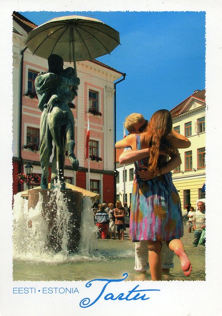
Tartu, Estonia

Uh oh. It's been a while.. I haven't really been in the mood for updating this blog, have had other things to do. ...such as finishing a massive desk I've been building with Matt since the start of the year. I can finally write postcards and letters by a desk and won't have to sit on our bed anymore! :D

Anyway. I'm starting today with this summery postcard from Estonia that mum and dad sent from their holiday last summer. I hope we'll get some warmer days here soon, too, I'd love to go out in a dress!


This is the fountain "Kissing Students" (Estonian: Suudlevad Tudengid) in Tartu, sculpted by M. Karmin, reminding visitors that the University of Tartu and its students have a profound effect on life in the city. ...and I love the couple at the front. :D

Wednesday, 22 April 2015

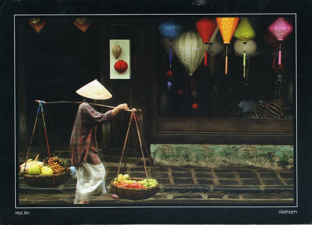
Hội An, Vietnam

I've posted about Hội An before, but I just *had* to post this one here as well, even if it's quite similar (lanterns, people, a street view) to the other card. I really like these postcards from Vietnam, I think they are gorgeous and I like the fact that they are a bit bigger than your standard postcard.


Hội An is a city of Vietnam, on the coast of the East Sea in the South Central Coast region of Vietnam. It is located in Quảng Nam Province and is home to approximately 120,000 inhabitants. It is recognized as a World Heritage Site by UNESCO. Hội An Ancient Town is an exceptionally well-preserved example of a South-East Asian trading port dating from the 15th to the 19th century. Its buildings and its street plan reflect the influences, both indigenous and foreign, that have combined to produce this unique heritage site.

The city possessed the largest harbour in Southeast Asia in the 1st century and was known as Lâm Ấp Phố (Champa City). Between the seventh and 10th centuries, the Cham (people of Champa) controlled the strategic spice trade and with this came tremendous wealth. The former harbour town of the Cham at the estuary of the Thu Bồn River was an important Vietnamese trading centre in the 16th and 17th centuries, where Chinese from various provinces as well as Japanese, Dutch and Indians settled. During this period of the China trade, the town was called Hai Pho (Seaside Town) in Vietnamese. Originally, Hai Pho was a divided town with the Japanese settlement across the "Japanese Bridge" (16th-17th century). The bridge (Chùa cầu) is a unique covered structure built by the Japanese, the only known covered bridge with a Buddhist temple attached to one side.

Napa Valley, California, USA

A lovely springtime view from the USA I received last year from a Year of the Horse stamp swap. Just look at the colours here!


Napa Valley AVA is an American Viticultural Area located in Napa County, California, United States. Napa Valley is considered one of the premier wine regions in the world. Records of commercial wine production in the region date back to the nineteenth century, but premium wine production dates back only to the 1960s.

The combination of Mediterranean climate, geography and geology of the region are conducive to growing quality wine grapes. John Patchett established the Napa Valley's first commercial vineyard in 1858. In 1861 Charles Krug established another of Napa Valley's first commercial wineries in St. Helena. Viticulture in Napa suffered several setbacks in the late 19th and early 20th centuries, including an outbreak of the vine disease phylloxera, the institution of Prohibition, and the Great Depression. The wine industry in Napa Valley recovered, and helped by the results of the Paris Wine Tasting of 1976, came to be seen as capable of producing the best quality wine – equal to that of Old World wine regions. Napa Valley is now a major enotourism destination.

Wednesday, 15 April 2015

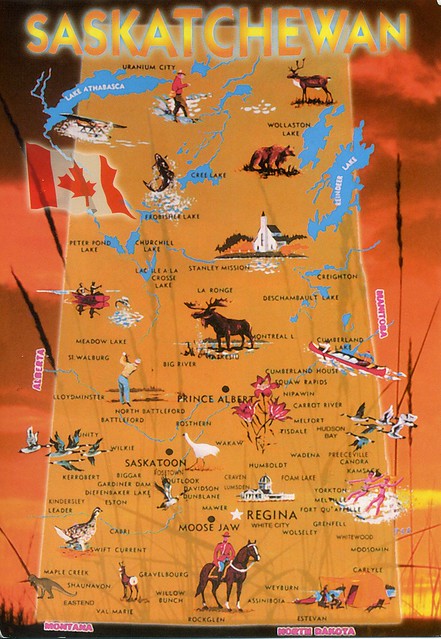
Saskatchewan, Canada

Another Lunar Year swap card, this time from Canada. This was officially a Year of the Horse swap, but the sender, Deanna, used older Lunar Year stamps as well. ...and managed to get me a wonderful special cancellation from Love! :)


Saskatchewan is a prairie province in Canada, which has a total area of 651,900 square kilometres and a land area of 592,534 square kilometres, the remainder being water area (covered by lakes/ponds, reservoirs and rivers). Saskatchewan is bordered on the west by the Province of Alberta, on the north by the Northwest Territories, on the east by Manitoba, and on the south by the U.S. states of Montana and North Dakota. As of December 2013, the population of Saskatchewan was estimated at 1,114,170. Residents primarily live in the southern half of the province. Of the total population, 257,300 live in the province's largest city, Saskatoon, while 210,000 live in the provincial capital, Regina. Other major cities include Prince Albert, Moose Jaw, Yorkton, Swift Current, and North Battleford.

Saskatchewan has been inhabited for thousands of years by various indigenous groups, and first explored by Europeans in 1690 and settled in 1774. It became a province in 1905, its name derived from the Saskatchewan River. The river was known as kisiskāciwani-sīpiy ("swift flowing river") in the Cree language. In the early 20th century the province became known as a stronghold for Canadian democratic socialism. Tommy Douglas, who was premier from 1944 to 1961, became the first social-democratic politician to be elected in North America. The province's economy is based on agriculture, mining, and energy. Saskatchewan's current premier is Brad Wall and its lieutenant-governor is Vaughn Solomon Schofield.

 In 1992, the federal and provincial governments signed a historic land claim agreement with Saskatchewan First Nations. The First Nations received compensation and were permitted to buy land on the open market for the tribes; they have acquired about 761,000 acres, now reserve lands. Some First Nations have used their settlement to invest in urban areas, including Saskatoon.

Wednesday, 8 April 2015

Taxco, Mexico

A nice view from Mexico, received from a swap last year. I would really like to visit Mexico one day, not the least because of the food. :P


Taxco de Alarcón (usually referred to as simply “Taxco”) is a small city and administrative center of a municipality of the same name (Taxco de Alarcón) located in the Mexican state of Guerrero. The name Taxco is most likely derived from the Nahuatl word tlacheco, which means “place of the ballgame.” However, one interpretation has the name coming from the word tatzco which means “where the father of the water is,” due to the high waterfall near the town center on Atatzin Mountain. “De Alarcón” is in honor of writer Juan Ruiz de Alarcón who was a native of the town. Like many municipalities in central Mexico, the municipality’s coat-of-arms is an Aztec glyph. This glyph is in the shape of a Mesoamerican ballcourt with rings, players and skulls, derived from the most likely source of Taxco’s name.

The city is heavily associated with silver, both with the mining of it and other metals and for the crafting of it into jewelry, silverware and other items. This reputation, along with the city’s picturesque homes and surrounding landscapes have made tourism the main economic activity as the only large-scale mining operation here is coming to a close.

Taxco is located in the north-central part of the state, 36 kilometres from the city of Iguala, 135 km from the state capital of Chilpancingo and 170 km southwest of Mexico City. The city was named one of Mexico’s “Pueblos Mágicos” (Magical Towns) due to the quality of the silverwork, the colonial constructions and the surrounding scenery.

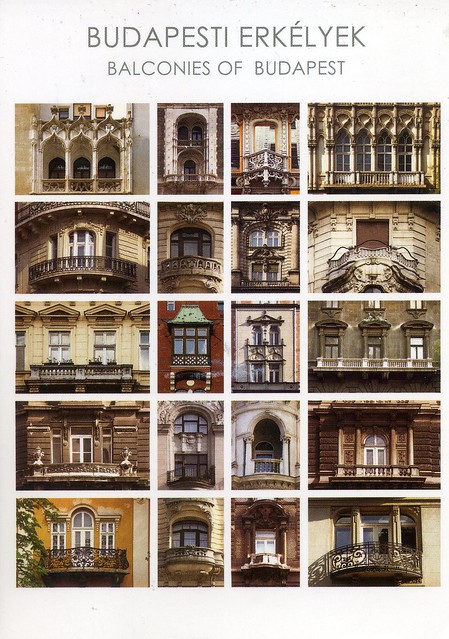
Balconies of Budapest, Hungary

A few more cards for today. :D This is an official I received last year.

 
HU-72316

Such pretty balconies! I love postcards showing little details like this, and this is one of the cases where I don't mind a multiview card.

Sunday, 5 April 2015

Bora Bora, French Polynesia

Another 'Vacation RR' postcard! :D This is such a gorgeous view, too. I'd love to be on a beach like this at the moment. :P


French Polynesia is an overseas collectivity of the French Republic; collectivité d'outre-mer de la République française (COM), sometimes unofficially referred to as an overseas country; pays d'outre-mer (POM). It is composed of 118 geographically dispersed islands and atolls stretching over an expanse of more than 2,000 kilometres in the South Pacific Ocean. Its total land area is 4,167 square kilometres.

French Polynesia is divided into 5 groups of islands: The Society Islands archipelago composed of the Windward Islands and the Leeward Islands, the Tuamotu Archipelago, the Gambier Islands, the Marquesas Islands and the Austral Islands. Among its 118 islands and atolls, 67 are inhabited. Tahiti, which is located within the Society Islands, is the most populous island and the seat of the capital of the collectivity, Pape'ete. Although not an integral part of its territory, Clipperton Island was administered from French Polynesia until 2007.

The commune of Bora-Bora is made up of the island of Bora Bora proper with its surrounding islets emerging from the coral reef, 29.3 km2 in total, and of the atoll of Tupai 11 km2, located 20 kilometres north of Bora Bora. The atoll of Tupai has no permanent population apart from some workers in the coconut plantations.

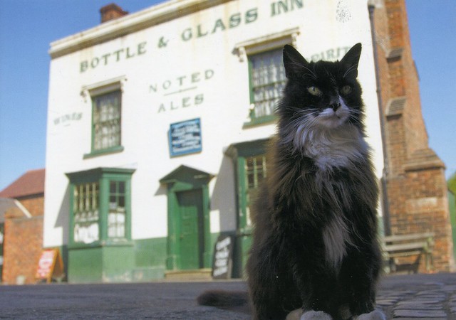
Sylvester at the Bottle and Gas, Black Country Living Museum, Dudley, England

A postcard I sent to myself last year as I wanted the UK Year of the Horse stamp cancelled on a postcard. ....and the Royal Mail actually cancelled the stamp! :O

 The Black Country Living Museum isn't too far from where I live. I've been there a couple of times, and I think I've been to this pub as well, although I don't think I had anything to drink... :P My favourite thing there is the fish & chip shop, their fish & chips are lovely, mmmm.. The downside is that a lot of people agree with me so normally you'll have to queue for *at least* half an hour, even after they opened a second chippy due to the demand. :P


The Black Country Living Museum is an open-air museum of rebuilt historic buildings in Dudley in the West Midlands of England. It is close to Dudley Castle in the centre of the Black Country conurbation. The museum occupies 105,000 square metres of former industrial land partly reclaimed from a former railway goods yard, disused lime kilns and former coal pits. It was opened in 1978, since when many more exhibits have been added.

 The museum preserves some important buildings from around the Metropolitan Boroughs of Dudley, Sandwell and Walsall and the City of Wolverhampton; mainly in a specially built village. Most buildings were relocated from their original sites to form a base from where demonstrators portray life in the period from the 1850s to the 1950s.

The museum is constantly changing as new exhibits, especially buildings, are being added.

Tuesday, 31 March 2015

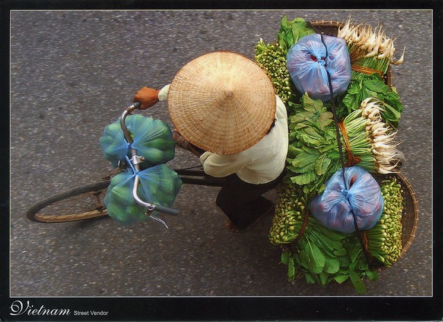
street vendor, Vietnam

One more card for today, another lovely Vietnam view showing local life, sent by Jo. :) There seem to be a lot of postcards like this available in Vietnam, and I absolutely adore these, in my opinion these are generally a lot nicer than your typical touristic views.


I don't think I'd be able to ride a bike with this much carriage...! :O This looks pretty impressive. ...not to mention all the produce here, which I assume must be pretty fresh as well. Mmmm... I'm getting hungry!

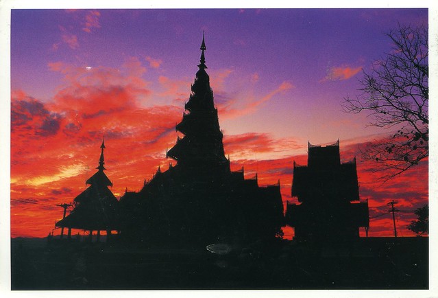
Mae Hong Son, Thailand

Continuing on the lunar year theme... I received this beautiful postcard last year. I was looking for postcards with Year of the Horse stamps and A of Thailand kindly agreed to swap with me.


Mae Hong Son is a town (thesaban mueang) in northwest Thailand, capital of Mae Hong Son Province. It is in the Shan Hills, near the border with Burma along the banks of the River Pai. As of 2005, the town had some 6,023 inhabitants.

Mae Hong Son Province is one of the northern provinces (changwat) of Thailand, on the country's western border. Neighboring provinces are (clockwise from north) Shan State of Myanmar, Chiang Mai and Tak. To the west, the province borders Kayin State and Kayah State of Myanmar.

The name Mae Hong Son means "the city of three mists". It is hemmed in by the high mountain ranges of the Shan Hills and is the most mountainous province in Thailand and is occupies 13,814 square kilometres. The province is covered with mist throughout the year and its terrain is highly suitable for the training of elephants.

Vyborg, Russia

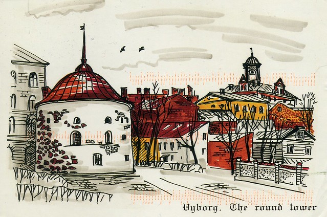
I'm from Lappeenranta, Finland. It's almost right on the Russian border but I've never been to Russia. ...and Vyborg would only be around 60 kilometres from where I've lived most of my life! It's just never happened. It does interest me, but my family aren't too bothered so I doubt I'll ever get to visit. Oh well, I do have a couple of postcards from Vyborg, this painted view being one of them.


Vyborg (Finnish: Viipuri) is a town and the administrative center of Vyborgsky District in Leningrad Oblast, Russia, located on the Karelian Isthmus near the head of the Vyborg Bay, 130 kilometers to the northwest of St. Petersburg and 38 kilometers south of Russia's border with Finland, where the Saimaa Canal enters the Gulf of Finland. Population: 79,962 (2010 Census).

The town lies in the boundary zone between the East Slavic/Russian and Finnish worlds and has changed hands several times in history, most recently in 1944 when it was taken by the Soviet Union from Finland during World War II.

The city hosts the Russian end of the 1,222 km Nord Stream gas pipeline, laid in 2011 and operated by a consortium led by Russia's Gazprom state hydrocarbons enterprise to pump 55 billion cu m of natural gas a year under the Baltic to Greifswald, Germany.

Round Tower, shown on this postcard, is a fortification at the market square of Vyborg. It was built in 1547–1550 by the order of Gustav I of Sweden as a part of the medieval town wall. Today it serves as a restaurant and is one of the most popular sights in Vyborg.

Round Tower was originally an arsenal. It was later used as a prison called "The Mutton Prison", a warehouse and since 1861 by the city magistrate. In 1938, as Vyborg was part of Finland, the tower was renovated for restaurant use after the design of architect Uno Ullberg. Tower's diameter is circa 21 meters.

Sunday, 22 March 2015

Barbados

...and here is the second postcard I received from Phyllis from her holiday last year. :) She does travel quite a bit - she'll be going away again on Tuesday. I'm not jealous at all, nooo... :P


Not that much to say about this... except that the views do look gorgeous and I wouldn't mind visiting Barbados at all. :D

Wednesday, 18 March 2015

Dubla Island, the Sundarbans, Bangladesh

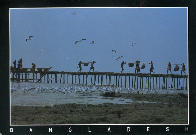
My dear friend Wanda visited Bangladesh a little over a year ago. I was cheeky and asked if she could send me some postcards, and she did. :) I've already posted one here before, but here's another. This one is actually a Unesco site as well!


The Sundarbans is a natural region in Bengal. It is the largest single block of tidal halophytic mangrove forest in the world. The Sundarbans covers approximately 10,000 square kilometres of which 60 percent is in Bangladesh with the remainder in India. The Sundarbans is a UNESCO World Heritage Site.

The Sundarbans National Park is a National Park, Tiger Reserve, and a Biosphere Reserve located in the Sundarbans delta in the Indian state of West Bengal. Sundarbans South, East and West are three protected forests in Bangladesh. This region is densely covered by mangrove forests, and is one of the largest reserves for the Bengal tiger.

Tunisia

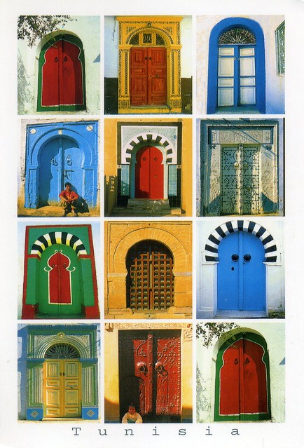
I have a bit of a thing for postcards showing doors and windows, so I was really happy to receive this one from Anne from her holiday. :)


Not much to say about this... except that I really like the colours here! I've seen some pretty nice doors in Bridgnorth here in England, too, you could do a similar postcard there.. :P

Sunday, 15 March 2015

Les Saintes, Terre-de-Haut, Guadeloupe

Phyllis, a friend of mine from volunteering, went on a Caribbean cruise last year. I was cheeky and asked if she could send me a couple of postcards from her trip, and she did send me two: this one of Guadeloupe mailed from Barbados, and one from Barbados. It would be so cool to go on one of those cruises myself one day... My Canadian pen friend has just been on one, too... *jealous* ..and my sister-in-law has just got a job on a cruise line so she'll get to visit some pretty amazing places as well, I'd think.


The Îles des Saintes ("Islands of the Saints"), also known as Les Saintes, is a small archipelago of the French Antilles located to the south of Basse-Terre Island, west of Marie-Galante and north of Dominica. It is a dependency of Guadeloupe, which, in turn, is an overseas department and region of France.

 Terre-de-Haut is a commune in the French overseas department of Guadeloupe, including Terre-de-Haut Island and a few other small uninhabited islands of the archipelago (les Roches Percées; Îlet à Cabrit; Grand-Îlet; la Redonde). It is the most populous island of the archipelago of the les Saintes.

Wednesday, 4 March 2015

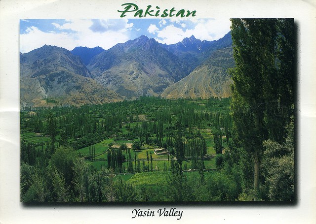
Yasin Valley, Pakistan

A nice view of Pakistan I received last year.


The Yasin Valley is a high mountain valley in the Hindu Kush mountains, in the northwest Ghizer District in Gilgit-Baltistan, Pakistan. Yasin is separated from the Ishkoman Valley by a high mountain pass. To reach Yasin one must take the Karakoram Highway north from Islamabad, and then turn left to reach Gupis in Ghizar. After Gupis, one continues northwest to reach the Yasin Valley. Yasin valley has a spectacular natural beauty.

Tuesday, 3 March 2015

Meknes, Morocco

A wonderful Unesco card from Morocco that I received last year. I was supposed to receive another card from the same person as well but that never arrived.. I'm kind of wondering whether they just forgot to send it or what happened there, but I wasn't very happy... :/ Anyway, Meknes is one of the so-called "King Cities" in Morocco.


The Historic City of Meknes has exerted a considerable influence on the development of the civil and military architecture (the kasbah) and works of art. Founded in 1061 A.D. by the Almoravids as a military stronghold, its name originates from the great Berber tribe Meknassa who dominated eastern Morocco as far back as the Tafilalet in the 8th century. Geographically, it is remarkably located in the Saïss Plain between the Middle Atlas and the pre-rifan massif of Zerhoun. It contains the vestiges of the Medina that bears witness to ancient socio-economic fabric and the imperial city created by the Sultan Moulay Ismail (1672-1727). It is the presence today of this historic city containing the rare remains and important monuments located within a rapidly changing urban environment that gives this urban heritage its universal value. The two ensembles are surrounded by a series of ramparts that separate them from one another. In addition to its architectural interest of being built in the Hispano-Moorish style, Meknes is of particular interest as it represents the first great work of the Alaouite dynasty, reflecting the grandeur of its creator. It also provides a remarkable approach of urban design, integrating elements of both Islamic and European architecture and town planning.

Behind the high defensive walls, pierced by nine monumental gates, are key monuments including twenty-five mosques, ten hammams, palaces, vast graneries, vestiges of fondouks (inns for merchants) and private houses, testimonies to the Almoravid, Merinid and Alaouite Periods.