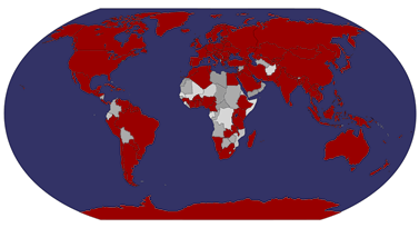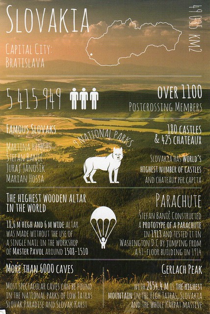
Slovakia seems to be in the same category as South Africa in my postcard collection - I only have a few cards from there as well. This card is from an Instagram swap from last year.
Slovakia, officially the Slovak Republic, is a landlocked country in Central Europe. It is bordered by the Czech Republic and Austria to the west, Poland to the north, Ukraine to the east and Hungary to the south. Slovakia's territory spans about 49,000 square kilometres and is mostly mountainous. The population is over 5 million and comprises mostly ethnic Slovaks. The capital and largest city is Bratislava. The official language is Slovak, a member of the Slavic language family.
The Slavs arrived in the territory of present-day Slovakia in the 5th and 6th centuries. In the 7th century, they played a significant role in the creation of Samo's Empire and in the 9th century established the Principality of Nitra. In the 10th century, the territory was integrated into the Kingdom of Hungary, which itself became part of the Habsburg Empire and the Austro-Hungarian Empire. After World War I and the dissolution of the Austro-Hungarian Empire, the Slovaks and Czechs established Czechoslovakia. A separate Slovak Republic (1939–1945) existed in World War II as a client state of Nazi Germany. In 1945, Czechoslovakia was reestablished under communist rule as a Soviet satellite. Slovakia became an independent state on 1 January 1993 after the peaceful dissolution of Czechoslovakia.
Slovakia is a high-income advanced economy. The country joined the European Union in 2004 and the Eurozone on 1 January 2009. Slovakia is also a member of the Schengen Area, NATO, the United Nations, the OECD and the WTO.
Showing posts with label slovakia. Show all posts
Sunday, 1 May 2016
Wednesday, 1 August 2012
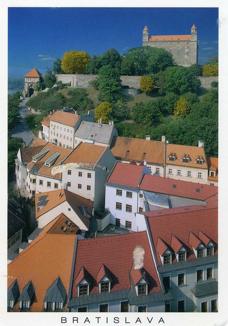
Bratislava, Slovakia
I just realised there's only one postcard from Slovakia in this blog so far.. well, here's another one :) ..and a really nice one, too, the old houses look so pretty!
Bratislava is the capital of Slovakia and, with a population of about 460,000, also the country's largest city. Bratislava is in southwestern Slovakia on both banks of the Danube River and on the left bank of Morava river. Bordering Austria and Hungary, it is the only national capital that borders two independent countries.
Bratislava is the political, cultural, and economic centre of Slovakia. It is the seat of the Slovak president, the parliament, and the Slovak Executive. It is home to several universities, museums, theatres, galleries and other important cultural and educational institutions. Many of Slovakia's large businesses and financial institutions also have headquarters there.
The history of the city has been strongly influenced by people of different nations and religions, namely by Austrians, Czechs, Germans, Hungarians, Slovaks, and Jews. The city was the capital of the Kingdom of Hungary, a part of the larger Habsburg Monarchy territories, from 1536 to 1783 and has been home to many Slovak, Hungarian, and German historical figures.
Bratislava is the capital of Slovakia and, with a population of about 460,000, also the country's largest city. Bratislava is in southwestern Slovakia on both banks of the Danube River and on the left bank of Morava river. Bordering Austria and Hungary, it is the only national capital that borders two independent countries.
Bratislava is the political, cultural, and economic centre of Slovakia. It is the seat of the Slovak president, the parliament, and the Slovak Executive. It is home to several universities, museums, theatres, galleries and other important cultural and educational institutions. Many of Slovakia's large businesses and financial institutions also have headquarters there.
The history of the city has been strongly influenced by people of different nations and religions, namely by Austrians, Czechs, Germans, Hungarians, Slovaks, and Jews. The city was the capital of the Kingdom of Hungary, a part of the larger Habsburg Monarchy territories, from 1536 to 1783 and has been home to many Slovak, Hungarian, and German historical figures.
Saturday, 28 May 2011
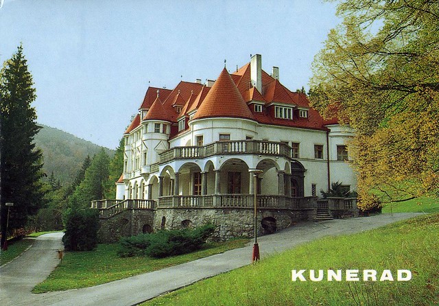
Kunerad, Slovakia
I don't have too many postcards from Slovakia so I was really happy to receive this from Wanda of Poland who went on holiday in Slovakia. Thank you so much!

Kunerad is a village and municipality in Žilina District in the Žilina Region of northern Slovakia. In historical records the village was first mentioned in 1490. The municipality lies at an altitude of 494 metres and covers an area of 22.937km². It has a population of about 931 people.

The stamp on the right is from a set of 11 definitives issued in 2009, while the stamp on the right was issued in 2010 and shows President Gasparovic.

Kunerad is a village and municipality in Žilina District in the Žilina Region of northern Slovakia. In historical records the village was first mentioned in 1490. The municipality lies at an altitude of 494 metres and covers an area of 22.937km². It has a population of about 931 people.

The stamp on the right is from a set of 11 definitives issued in 2009, while the stamp on the right was issued in 2010 and shows President Gasparovic.
Subscribe to:
Posts (Atom)


Maroon