Shetland is an archipelago in Scotland, off the northeast coast. The islands lie to the northeast of Orkney, 280 km from the Faroe Islands and form part of the division between the Atlantic Ocean to the west and the North Sea to the east. The total area is approximately 1,466 km2. Administratively, the area is one of the 32 council areas of Scotland for which the now-archaic spelling Zetland was used until 1970. The islands' administrative centre and only burgh is Lerwick.
The largest island, known as the "Mainland", has an area of 967 km2, making it the third-largest Scottish island and the fifth-largest of the British Isles.
Out of the approximately 100 islands, only 15 are inhabited. The main island of the group is known as Mainland. The other inhabited islands are: Bressay, Burra, Fetlar, Muckle Roe, Papa Stour, Trondra, Vaila, Unst, Whalsay, Yell in the main Shetland group, plus Foula to the south-west, Fair Isle to the south, and Housay and Bruray in the Out Skerries to the east.
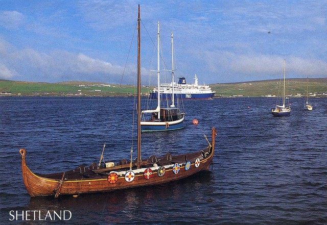
On this postcard you can see P&O ferry St Clair leaving Lerwick. P&O Scottish Ferries operate regular ro-ro sailings to Aberdeen and Stromness from Lerwick. Replica longship Dim Riv in foreground, Bressau in background. St Clair operates to Aberdeen and to Bergen in summer.


 Maroon


")


No comments:
Post a Comment