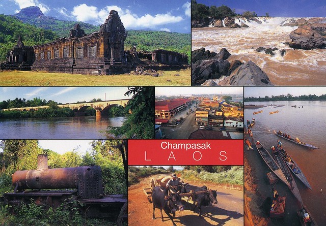
Champasak is a province in southwestern Laos, near the borders with Thailand and Cambodia. It is one of the three principalities that succeeded the Lao kingdom of Lan Xang. In 2005, it had a reported population of 607,333. The capital is Pakse, but it takes its name from Champasak, the former capital of the Kingdom of Champasak. Champasak Province covers an area of 15,415 square kilometres. It is bordered by Salavan Province to the north, Sekong Province to the northeast, Attapeu Province to the east, Cambodia to the south, and Thailand to the west. The river Mekong forms part of the border with neighboring Thailand and contains Si Phan Don (Four Thousand Islands) in the south of the province, on the border with Cambodia.
Champasak has played a central role in the history of Siam and Laos, with frequent battles taking place in and around Champasak. Its rich cultural heritage includes ancient temple ruins and French colonial architecture. Champasak has some 20 wats (temples), such as Wat Phou, Wat Luang, and Wat Tham Fai. Freshwater dolphins and the province's many waterfalls are tourist attractions.
The Champasak cultural landscape, including the Vat Phou Temple complex, is a remarkably well-preserved planned landscape more than 1,000 years old. It was shaped to express the Hindu vision of the relationship between nature and humanity, using an axis from mountain top to river bank to lay out a geometric pattern of temples, shrines and waterworks extending over some 10 km. Two planned cities on the banks of the Mekong River are also part of the site, as well as Phou Kao mountain. The whole represents a development ranging from the 5th to 15th centuries, mainly associated with the Khmer Empire.


 Maroon


")


No comments:
Post a Comment