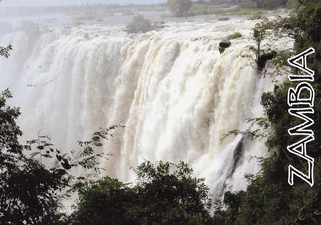
This is only my second postcard from Zambia. ...and it's a Unesco card as well! :)
Victoria Falls, or Mosi-oa-Tunya (Tokaleya Tonga: the Smoke that Thunders), is a waterfall in southern Africa on the Zambezi River at the border of Zambia and Zimbabwe.
The Mosi-oa-Tunya/Victoria Falls is the world’s greatest sheet of falling water and significant worldwide for its exceptional geological and geomorphological features and active land formation processes with outstanding beauty attributed to the falls i.e. the spray, mist and rainbows. This transboundary property extends over 6860 ha and comprises 3779 ha of the Mosi-oa-Tunya National Park (Zambia), 2340 ha of Victoria Falls National Park (Zimbabwe), 741 ha of the riverine strip of Zambezi National Park (Zimbabwe). A riverine strip of the Zambezi National Park extending 9 km west along the right bank of the Zambezi and islands in the river are all within the Park as far as Palm and Kandahar Islands, with the Victoria Falls being one of the major attractions. The waterfall stands at an altitude of about 915 m above mean sea level (a.m.s.l.) and spans to about 1708 m wide with an average depth of 100 m and the deepest point being 108 m. Sprays from this giant waterfall can be seen from a distance of 30 km from the Lusaka road, Zambia and 50 km from Bulawayo road, Zimbabwe. Basalts have been cut by a river system producing a series of eightspectacular gorges that serve as breeding sites for four species of endangered birds. The basalts of the Victoria Falls World Heritage property are layered unlike those of the Giants Causeway World Heritage site which are vertical and columnar.
Subscribe to:
Post Comments (Atom)


 Maroon


1 comment:
oh my the stamp is so cute...look at me i am spamming your blog with comments :D haven't 'been' here for a while, and you have a really nice postcard collection :D
Post a Comment