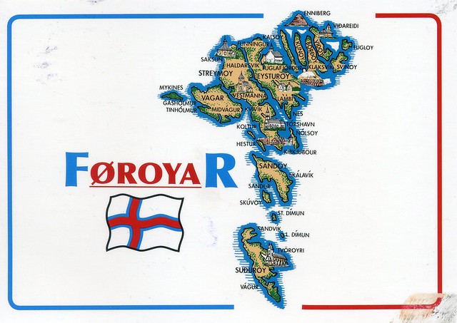
A wonderful map card I received from dear Johanna in Finland just over a year ago. This card was mailed from Finland but Johanna has actually been to the Faroe Islands - and sent me a postcard, which I blogged about here.
The Faroe Islands is an archipelago and autonomous country within the Kingdom of Denmark, situated between the Norwegian Sea and the North Atlantic Ocean, approximately halfway between Norway and Iceland, at about 320 kilometres north-north-west of mainland Scotland. The total area is approximately 1,400 km2 with a 2010 population of almost 50,000 people.
The Faroe Islands have been a self-governing country within the Danish Realm since 1948. Over the years, the Faroese have taken control of most domestic matters. Areas that remain the responsibility of Denmark include military defence, police, justice, currency and foreign affairs. The Faroe Islands also have representatives in the Nordic Council as members of the Danish delegation.
The islands were associated with and taxed by Norway, then the Union of Kalmar, and then Denmark–Norway until 1814, when Norway was united with Sweden. Scandinavia was in political turmoil following the Sixth Coalition of the Napoleonic Wars, when the Treaty of Kiel granted Denmark control over the Faroes, Iceland and Greenland in 1814. The Danish trade monopoly ended in 1856.
Subscribe to:
Post Comments (Atom)


 Maroon


No comments:
Post a Comment