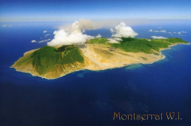
Montserrat is a Caribbean island that is a British overseas territory. It is located in the Leeward Islands, part of the chain of islands known as the Lesser Antilles, in the West Indies. The island of Montserrat measures approximately 16 km long and 11 km wide, with approximately 40 kilometres of coastline.
On July 18 1995, the previously dormant Soufrière Hills volcano became active. Eruptions destroyed Montserrat's Georgian era capital city of Plymouth and two-thirds of the island's population was forced to flee. The volcanic activity continues to the present, the affected areas currently being mostly in the vicinity of Plymouth, including its docking facilities, and also on the eastern side of the island in the area around the former W. H. Bramble Airport, the remnants of which were buried by flows from volcanic activity on February 11, 2010.
An "exclusion zone" extending from the south coast of the island north to parts of the Belham Valley has been imposed because of the size of the existing volcanic dome and the resulting potential for pyroclastic activity. Presently visitors are not permitted entry into the exclusion zone, but an impressive view of the destruction of Plymouth can be seen from the top of Garibaldi Hill in Isles Bay. Relatively quiet since early 2010, the volcano continues to be closely monitored by the Montserrat Volcano Observatory.
A new town and port is being developed at Little Bay in the northwest of the island. While construction proceeds, the centre of government rests at Brades.


 Maroon


")


No comments:
Post a Comment