
The first card, above, is from a facebook swap with Abran last year, while the second card below is an official I received in 2011.
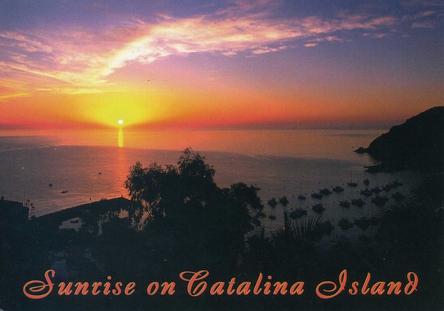
Santa Catalina Island, often called Catalina Island, or just Catalina, is a rocky island off the coast of the U.S. state of California in the Gulf of Santa Catalina. The island is 35 km long and 13 km across at its greatest width. The island is located about 35 km south-southwest of Los Angeles, California. The highest point on the island is 639m Mt. Orizaba. One of the Channel Islands of California archipelago, Catalina lies within Los Angeles County.
Catalina was originally settled by Native Americans who called the island Pimugna or Pimu and referred to themselves as Pimugnans or Pimuvit. The first Europeans to arrive on Catalina claimed it for the Spanish Empire. Over the years, territorial claims to the island transferred to Mexico and then to the United States. During this time, the island was sporadically used for smuggling, otter hunting, and gold-digging, before successfully being developed into a tourist destination by chewing gum magnate William Wrigley, Jr. beginning in the 1920s. Since the 1970s, most of the island has been administered by the Catalina Island Conservancy.
The total population as of the 2010 census was 4,096 persons, 90 percent of whom live in the island's only incorporated city, Avalon. The second center of population is the unincorporated village of Two Harbors at the island's isthmus. Development occurs also at the smaller settlements of Rancho Escondido and Middle Ranch. The remaining population is scattered over the island between the two population centers.

The postcard I received in 2012 has a printed postage label so I'm only showing the stamps on the official card. I love the dog stamps!


 Maroon


")


No comments:
Post a Comment