This is another card from a 'favourites' swap from last year. I don't have too many postcards from Chile so I was really excited to receive this one!
Torres del Paine National Park is a national park encompassing mountains, glaciers, lakes, and rivers in southern Chilean Patagonia. The Cordillera del Paine is the centerpiece of the park. It lies in a transition area between the Magellanic subpolar forests and the Patagonian Steppes. The park is located 112 km north of Puerto Natales and 312 km north of Punta Arenas. The park borders Bernardo O'Higgins National Park to the west and the Los Glaciares National Park to the north in Argentine territory.
Torres del Paine National Park is part of the Sistema Nacional de Áreas Silvestres Protegidas del Estado de Chile (National System of Protected Forested Areas of Chile). In 2006, it measured approximately 242,242 hectares. It is one of the largest and most visited parks in Chile. The park averages around 150,000 visitors a year, of which 60% are foreign tourists, who come from all over the world.
The park is one of the 11 protected areas of the Magallanes Region and Chilean Antarctica (together with four national parks, three national reserves, and three national monuments). Together, the protected forested areas comprise about 51% of the land of the region (6,728,744 hectares).
The Torres del Paine are the peaks of the mountain range, Cerro Paine. They extend 3,050 meters above sea level, and are joined by the Cuernos del Paine. The area also boasts valleys, rivers such as the Paine, lakes, and glaciers. The well-known lakes include Grey, Pehoé, Nordenskjold, and Sarmiento. The glaciers, including Grey, Pingo, Tyndall and Geikie, belong to the Southern Patagonia Ice Field.
Saturday, 29 June 2013
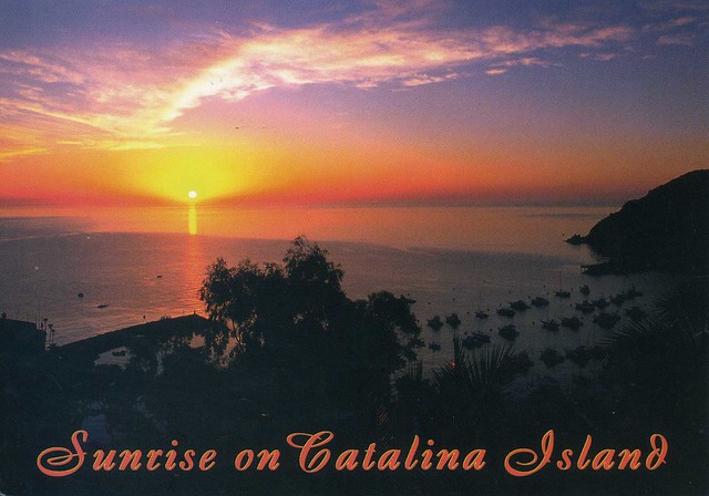
Catalina Island, California, USA
I realised I had two postcards showing Catalina Island in California, USA, so why not have them both in the same post?
The first card, above, is from a facebook swap with Abran last year, while the second card below is an official I received in 2011.
US-1297946
Santa Catalina Island, often called Catalina Island, or just Catalina, is a rocky island off the coast of the U.S. state of California in the Gulf of Santa Catalina. The island is 35 km long and 13 km across at its greatest width. The island is located about 35 km south-southwest of Los Angeles, California. The highest point on the island is 639m Mt. Orizaba. One of the Channel Islands of California archipelago, Catalina lies within Los Angeles County.
Catalina was originally settled by Native Americans who called the island Pimugna or Pimu and referred to themselves as Pimugnans or Pimuvit. The first Europeans to arrive on Catalina claimed it for the Spanish Empire. Over the years, territorial claims to the island transferred to Mexico and then to the United States. During this time, the island was sporadically used for smuggling, otter hunting, and gold-digging, before successfully being developed into a tourist destination by chewing gum magnate William Wrigley, Jr. beginning in the 1920s. Since the 1970s, most of the island has been administered by the Catalina Island Conservancy.
The total population as of the 2010 census was 4,096 persons, 90 percent of whom live in the island's only incorporated city, Avalon. The second center of population is the unincorporated village of Two Harbors at the island's isthmus. Development occurs also at the smaller settlements of Rancho Escondido and Middle Ranch. The remaining population is scattered over the island between the two population centers.
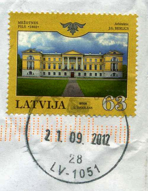
The postcard I received in 2012 has a printed postage label so I'm only showing the stamps on the official card. I love the dog stamps!
The first card, above, is from a facebook swap with Abran last year, while the second card below is an official I received in 2011.
Santa Catalina Island, often called Catalina Island, or just Catalina, is a rocky island off the coast of the U.S. state of California in the Gulf of Santa Catalina. The island is 35 km long and 13 km across at its greatest width. The island is located about 35 km south-southwest of Los Angeles, California. The highest point on the island is 639m Mt. Orizaba. One of the Channel Islands of California archipelago, Catalina lies within Los Angeles County.
Catalina was originally settled by Native Americans who called the island Pimugna or Pimu and referred to themselves as Pimugnans or Pimuvit. The first Europeans to arrive on Catalina claimed it for the Spanish Empire. Over the years, territorial claims to the island transferred to Mexico and then to the United States. During this time, the island was sporadically used for smuggling, otter hunting, and gold-digging, before successfully being developed into a tourist destination by chewing gum magnate William Wrigley, Jr. beginning in the 1920s. Since the 1970s, most of the island has been administered by the Catalina Island Conservancy.
The total population as of the 2010 census was 4,096 persons, 90 percent of whom live in the island's only incorporated city, Avalon. The second center of population is the unincorporated village of Two Harbors at the island's isthmus. Development occurs also at the smaller settlements of Rancho Escondido and Middle Ranch. The remaining population is scattered over the island between the two population centers.
The postcard I received in 2012 has a printed postage label so I'm only showing the stamps on the official card. I love the dog stamps!
Labels:
2011,
2012,
california,
catalina island,
facebook,
officials,
usa
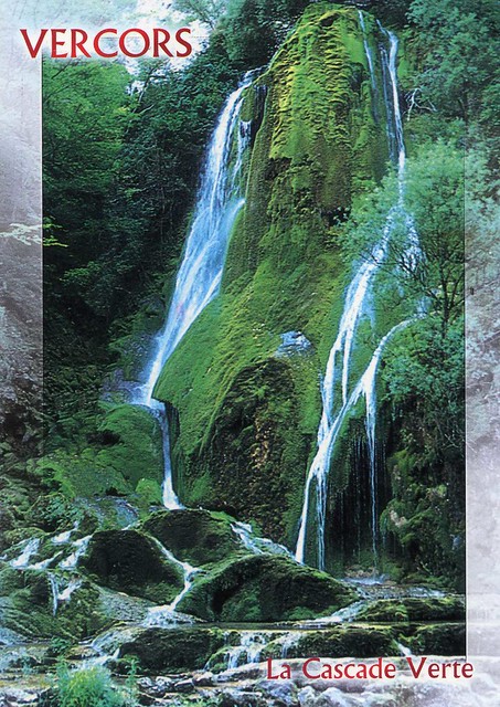
La Cascade Verte, Vercors, France
A wonderful official I received from France last year.
FR-231512
The Vercors is a range of plateaux and mountains in the départements of Isère and Drôme in the French Prealps. It lies west of the Dauphiné Alps, from which it is separated by the rivers Drac and Isère. Cliffs at its eastern edge face the city of Grenoble.
The plateau's karstic area includes the famous Vercors Cave System which includes Gouffre Berger.
The Vercors has several resorts for cross-country skiing and for down-hill skiing. Villard-de-Lans is the biggest down-hill ski resort.
The plateau's karstic area includes the famous Vercors Cave System which includes Gouffre Berger.
The Vercors has several resorts for cross-country skiing and for down-hill skiing. Villard-de-Lans is the biggest down-hill ski resort.
Tunnel of Love, Klevan, Ukraine
Last year I participated in a photography contest on the Postcrossing blog where the task was to take a picture of a place special to you/a secret place most people don't know about. I don't usually have any luck in competitions so I was really surprised to find out I was one of the three winners. The prize was a pack of 100 postcards made using the photo. I really like mine, they are nice and shiny and large so there's lots of room for writing (although it would be nice if the backs of the cards weren't completely blank...). One of the other winners, fuegoazul from Ukraine, agreed to a swap with me which I'm really happy about as her photo is simply stunning. Just look at it!
I wish I would've thought of adding text to the front of the cards as well! You can read more about this place in the link above, it really does sound like something out of a fairytale!
Klevan is an urban-type settlement in the Rivne Raion (district) of Rivne Oblast (province) in western Ukraine. Its population is 7,470 as of the 2001 Ukrainian Census.
I wish I would've thought of adding text to the front of the cards as well! You can read more about this place in the link above, it really does sound like something out of a fairytale!
Klevan is an urban-type settlement in the Rivne Raion (district) of Rivne Oblast (province) in western Ukraine. Its population is 7,470 as of the 2001 Ukrainian Census.
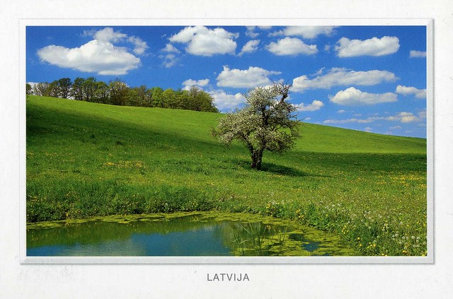
Latvia
This card is from a 'favourites' swap I did last year with Zane in Latvia. She sent me a bunch of truly gorgeous postcards, this one might well be my favourite although it was really hard to pick!
I can't really say anything about the place on this card, it's not mentioned anywhere. ..so it's just a random, very pretty place in Latvia. :P
Saturday, 4 May 2013
The Bahamas
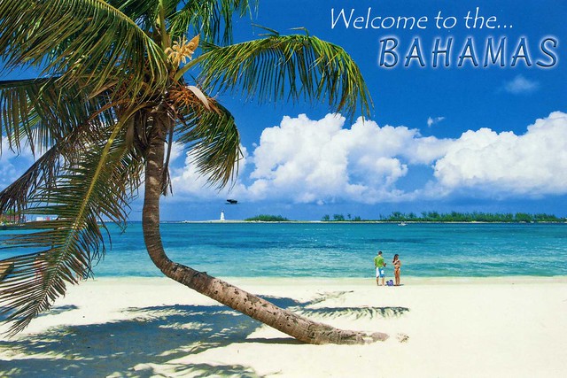
One more card for today... and it's a new country to my collection! Well, not exactly, but it IS my first written and stamped postcard from the Bahamas, the previous one (which I posted about here) ended up being mailed from the USA as the first one got lost. It looks like such a lovely beach, too!

The Bahamas, officially the Commonwealth of the Bahamas, is a country consisting of more than 700 islands, cays, and islets in the Atlantic Ocean; north of Cuba and Hispaniola (the Dominican Republic and Haiti); northwest of the Turks and Caicos Islands; southeast of the U.S. state of Florida and east of the Florida Keys. Its capital is Nassau on the island of New Providence. Geographically, the Bahamas lie near to Cuba, which is part of the Greater Antilles, along with Hispaniola and Jamaica. The designation of "Bahamas" refers to the country and the geographic chain that it shares with the Turks and Caicos Islands. The three West Indies/Caribbean island groupings are: The Bahamas, the Greater Antilles, and the Lesser Antilles. As stated on the mandate/manifesto of The Royal Bahamas Defence Force, The Bahamas territory encompasses 180,000 square miles of ocean space. From the Cay Sal Bank and Cay Lobos (just off of the coast of Cuba) in the west, to San Salvador, The Bahamas is much larger than is recorded in some sources.
Originally inhabited by the Lucayan, a branch of the Arawakan-speaking Taino people, the Bahamas were the site of Columbus' first landfall in the New World in 1492. Although the Spanish never colonized the Bahamas, they shipped the native Lucayans to slavery in Hispaniola. The islands were mostly deserted from 1513 until 1648, when English colonists from Bermuda settled on the island of Eleuthera.
The Bahamas became a British Crown colony in 1718, when the British clamped down on piracy. After the American War of Independence, thousands of American Loyalists, taking their enslaved Africans, moved to the Bahamas, where the Americans set up a plantation economy. After Britain abolished the international slave trade in 1807, the Royal Navy resettled many free Africans liberated from illegal slave ships in the Bahamas during the 19th century. Hundreds of American slaves and Black Seminoles escaped to the islands from Florida, and nearly 500 were freed from American merchant ships in the domestic trade. Slavery in the Bahamas was abolished in 1834. Today the descendants of slaves and free Africans form the majority of the population; issues related to the slavery years are part of society. The Bahamas became an independent Commonwealth realm in 1973, retaining Queen Elizabeth II as monarch.
In terms of Gross Domestic Product per capita, the Bahamas is one of the richest countries in the Americas (following the United States and Canada).
The Bahamas, officially the Commonwealth of the Bahamas, is a country consisting of more than 700 islands, cays, and islets in the Atlantic Ocean; north of Cuba and Hispaniola (the Dominican Republic and Haiti); northwest of the Turks and Caicos Islands; southeast of the U.S. state of Florida and east of the Florida Keys. Its capital is Nassau on the island of New Providence. Geographically, the Bahamas lie near to Cuba, which is part of the Greater Antilles, along with Hispaniola and Jamaica. The designation of "Bahamas" refers to the country and the geographic chain that it shares with the Turks and Caicos Islands. The three West Indies/Caribbean island groupings are: The Bahamas, the Greater Antilles, and the Lesser Antilles. As stated on the mandate/manifesto of The Royal Bahamas Defence Force, The Bahamas territory encompasses 180,000 square miles of ocean space. From the Cay Sal Bank and Cay Lobos (just off of the coast of Cuba) in the west, to San Salvador, The Bahamas is much larger than is recorded in some sources.
Originally inhabited by the Lucayan, a branch of the Arawakan-speaking Taino people, the Bahamas were the site of Columbus' first landfall in the New World in 1492. Although the Spanish never colonized the Bahamas, they shipped the native Lucayans to slavery in Hispaniola. The islands were mostly deserted from 1513 until 1648, when English colonists from Bermuda settled on the island of Eleuthera.
The Bahamas became a British Crown colony in 1718, when the British clamped down on piracy. After the American War of Independence, thousands of American Loyalists, taking their enslaved Africans, moved to the Bahamas, where the Americans set up a plantation economy. After Britain abolished the international slave trade in 1807, the Royal Navy resettled many free Africans liberated from illegal slave ships in the Bahamas during the 19th century. Hundreds of American slaves and Black Seminoles escaped to the islands from Florida, and nearly 500 were freed from American merchant ships in the domestic trade. Slavery in the Bahamas was abolished in 1834. Today the descendants of slaves and free Africans form the majority of the population; issues related to the slavery years are part of society. The Bahamas became an independent Commonwealth realm in 1973, retaining Queen Elizabeth II as monarch.
In terms of Gross Domestic Product per capita, the Bahamas is one of the richest countries in the Americas (following the United States and Canada).
Masjed-e Jāmé, Isfahan, Iran
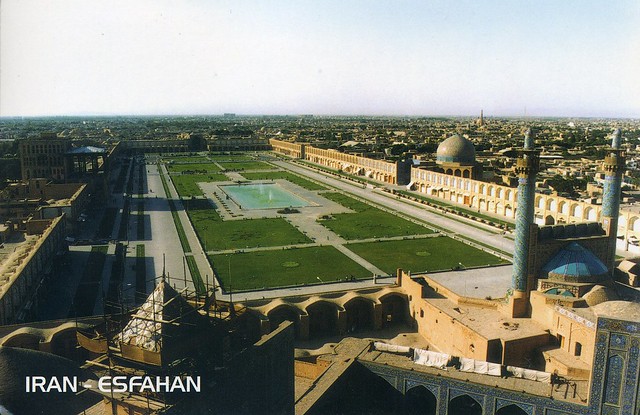
This card is a bit older... I received this one back in 2009, from a tag on the Postcrossing forum. I've been reading a Middle East cookbook recently and there are lots of yummy-sounding Iranian recipes in it that I'd love to try, mmmmm... Well, here's a postcard from Iran, then, to keep up with the theme :P
Located in the historic centre of Isfahan, the Masjed-e Jāmé (‘Friday mosque’) can be seen as a stunning illustration of the evolution of mosque architecture over twelve centuries, starting in ad 841. It is the oldest preserved edifice of its type in Iran and a prototype for later mosque designs throughout Central Asia. The complex, covering more than 20,000 m2, is also the first Islamic building that adapted the four-courtyard layout of Sassanid palaces to Islamic religious architecture. Its double-shelled ribbed domes represent an architectural innovation that inspired builders throughout the region. The site also features remarkable decorative details representative of stylistic developments over more than a thousand years of Islamic art.
Chaguaramas, Trinidad & Tobago
Flickr doesn't seem to like me today... and that's where all my postcard pictures are saved :/ I tried to post a different card here just but I'm having problems uploading the picture. Oh well, here's a different one - a gorgeous sunrise view from Trinidad and Tobago, received from a Facebook swap with Nalini last year. :)

Chaguaramas lies in the North West Peninsula of Trinidad west of Port of Spain; the name is often applied to the entire peninsula, but is sometimes used to refer to the most developed area. The entire peninsula was leased to the United States in 1940 for the construction of a naval base under the Destroyers for Bases Agreement. The base was also used during the early 1960s as a BMEWS early warning radar site, as well as serving as a missile tracking site on the U.S. Air Force Eastern Test Range. The base was scaled back in 1956 and the area was returned to Trinidad and Tobago control in 1963.
Chaguaramas was the location slated for the construction of the capital of the short-lived West Indies Federation. It is also the place where the Treaty of Chaguaramas was signed, establishing Caricom, the Caribbean Community and Common Market, in 1973.
The Chaguaramas Peninsula supports one of the few remaining areas of dry forest in western Trinidad. It has been the center of yachting activity in Trinidad. The Chaguaramas area also contains some dockside facilities, mostly for the transfer of bauxite ore between ship and shore, or from smaller boats to ocean-going vessels. The function of such docks is easily recognizable as the docks and buildings are colored pink from the bauxite dust. The waterways in this area are considered excellent by divers and fishermen.
Chaguaramas lies in the North West Peninsula of Trinidad west of Port of Spain; the name is often applied to the entire peninsula, but is sometimes used to refer to the most developed area. The entire peninsula was leased to the United States in 1940 for the construction of a naval base under the Destroyers for Bases Agreement. The base was also used during the early 1960s as a BMEWS early warning radar site, as well as serving as a missile tracking site on the U.S. Air Force Eastern Test Range. The base was scaled back in 1956 and the area was returned to Trinidad and Tobago control in 1963.
Chaguaramas was the location slated for the construction of the capital of the short-lived West Indies Federation. It is also the place where the Treaty of Chaguaramas was signed, establishing Caricom, the Caribbean Community and Common Market, in 1973.
The Chaguaramas Peninsula supports one of the few remaining areas of dry forest in western Trinidad. It has been the center of yachting activity in Trinidad. The Chaguaramas area also contains some dockside facilities, mostly for the transfer of bauxite ore between ship and shore, or from smaller boats to ocean-going vessels. The function of such docks is easily recognizable as the docks and buildings are colored pink from the bauxite dust. The waterways in this area are considered excellent by divers and fishermen.
Tongariro National Park, New Zealand
Another national park and another Unesco site... I didn't realise that when I picked today's cards! This one is from the lovely Heather, she sent me two wonderful postcards from New Zealand and this is one of them.

Tongariro National Park is the oldest national park in New Zealand, located in the central North Island. It has been acknowledged by UNESCO as one of the 28 mixed cultural and natural World Heritage Sites.
Tongariro National Park was the fourth national park established in the world. The active volcanic mountains Ruapehu, Ngauruhoe, and Tongariro are located in the centre of the park.
There are a number of Māori religious sites within the parkand the summits of Tongariro, including Ngauruhoe and Ruapehu, are tapu (sacred). The park includes many towns around its boundary including Ohakune, Waiouru, Horopito, Pokaka, Erua, National Park Village, Whakapapa skifield and Turangi.
This is the main reason I picked this card.. Heather used a 'Hobbit' stamp!! I was so excited to receive this, yay!
Tongariro National Park is the oldest national park in New Zealand, located in the central North Island. It has been acknowledged by UNESCO as one of the 28 mixed cultural and natural World Heritage Sites.
Tongariro National Park was the fourth national park established in the world. The active volcanic mountains Ruapehu, Ngauruhoe, and Tongariro are located in the centre of the park.
There are a number of Māori religious sites within the parkand the summits of Tongariro, including Ngauruhoe and Ruapehu, are tapu (sacred). The park includes many towns around its boundary including Ohakune, Waiouru, Horopito, Pokaka, Erua, National Park Village, Whakapapa skifield and Turangi.
This is the main reason I picked this card.. Heather used a 'Hobbit' stamp!! I was so excited to receive this, yay!
Labels:
2013,
friends,
national parks,
new zealand,
stamps,
surprises,
unesco
Þingvellir, Iceland
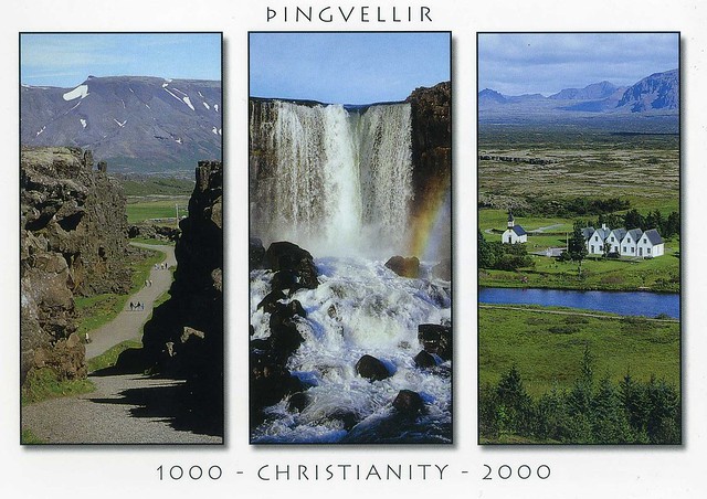
Last year I did a swap with Hanna in Iceland, through Heather's great Facebook postcard group. I received a bunch of lovely postcards from Hanna so I'll probably post some more here later (or at least I'm hoping to...). For now I picked this one showing Þingvellir, one of Iceland's Unesco sites.

Þingvellir is a place in Bláskógabyggð in southwestern Iceland, near the peninsula of Reykjanes and the Hengill volcanic area. Þingvellir is a site of historical, cultural, and geological importance and is one of the most popular tourist destinations in Iceland. It is the site of a rift valley that marks the crest of the Mid-Atlantic Ridge. It is also home to Þingvallavatn, the largest natural lake in Iceland.
Parliament or Alþingi was established at Þingvellir in 930 and remained there until 1789. Þingvellir National Park was founded in 1930 to protect the remains of the parliament site and was later expanded to protect natural phenomena in the surrounding area. Þingvellir National Park was the first national park in Iceland and was decreed "a protected national shrine for all Icelanders, the perpetual property of the Icelandic nation under the preservation of parliament, never to be sold or mortgaged."
Þingvellir is a place in Bláskógabyggð in southwestern Iceland, near the peninsula of Reykjanes and the Hengill volcanic area. Þingvellir is a site of historical, cultural, and geological importance and is one of the most popular tourist destinations in Iceland. It is the site of a rift valley that marks the crest of the Mid-Atlantic Ridge. It is also home to Þingvallavatn, the largest natural lake in Iceland.
Parliament or Alþingi was established at Þingvellir in 930 and remained there until 1789. Þingvellir National Park was founded in 1930 to protect the remains of the parliament site and was later expanded to protect natural phenomena in the surrounding area. Þingvellir National Park was the first national park in Iceland and was decreed "a protected national shrine for all Icelanders, the perpetual property of the Icelandic nation under the preservation of parliament, never to be sold or mortgaged."
Labels:
2012,
facebook,
iceland,
national parks,
swap,
unesco,
Þingvellir
Northern Ireland
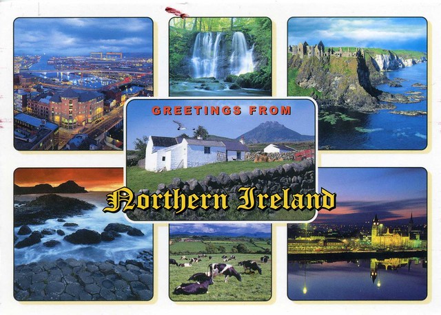
Time for a little update again, I think.. I don't intend to leave such huge breaks between updates but it just happens. Uh-oh... Anyway, today's first card is from my friend Tiphaine. She visited her brother in Northern Ireland earlier this year and was sweet enough to send me a postcard from her trip :) I don't have too many postcards from Northern Ireland so this was quite a treat as well!

Northern Ireland is a part of the United Kingdom in the north-east of the island of Ireland. As of 2011, its population was 1,810,863, constituting about 30% of the island's total population and about 3% of the population of the United Kingdom. Since the signing of the Good Friday Agreement in 1998, Northern Ireland is largely self-governing. According to the agreement, Northern Ireland co-operates with the rest of Ireland – from which it was partitioned in 1921 – on some policy areas, while other areas are reserved for the Government of the United Kingdom, though the Republic of Ireland "may put forward views and proposals".
Northern Ireland was for many years the site of a violent and bitter inter-communal conflict – the Troubles – which was caused by divisions between nationalists, who see themselves as Irish and are predominantly Roman Catholic, and unionists, who see themselves as British and are predominantly Protestant. Additionally, some people from either side of the community describe themselves as Northern Irish. Unionists want Northern Ireland to remain as a part of the United Kingdom, while nationalists want reunification with the rest of Ireland, independent of British rule. Since 1998, most of the paramilitary groups involved in the Troubles have ceased their armed campaigns.
Northern Ireland has traditionally been the most industrialised region of the island. After declining as a result of political and social turmoil in the second half of the 20th century, it has grown significantly since the 1990s. This is in part due to a "peace dividend" and in part due to links and increased trade with the Republic of Ireland.
This card shows a few places in Northern Ireland: Belfast City, Glens of Antrim waterfalls, Dunluce Castle, the Giant's Causeway (which is also a Unesco site) and City of Derry.
You wouldn't actually need an international stamp to mail a postcard from Nothern Ireland to England.. which is why I don't see too many of these. It's a shame the stamp isn't cancelled, but that seems to happen a lot in the UK. :/
Northern Ireland is a part of the United Kingdom in the north-east of the island of Ireland. As of 2011, its population was 1,810,863, constituting about 30% of the island's total population and about 3% of the population of the United Kingdom. Since the signing of the Good Friday Agreement in 1998, Northern Ireland is largely self-governing. According to the agreement, Northern Ireland co-operates with the rest of Ireland – from which it was partitioned in 1921 – on some policy areas, while other areas are reserved for the Government of the United Kingdom, though the Republic of Ireland "may put forward views and proposals".
Northern Ireland was for many years the site of a violent and bitter inter-communal conflict – the Troubles – which was caused by divisions between nationalists, who see themselves as Irish and are predominantly Roman Catholic, and unionists, who see themselves as British and are predominantly Protestant. Additionally, some people from either side of the community describe themselves as Northern Irish. Unionists want Northern Ireland to remain as a part of the United Kingdom, while nationalists want reunification with the rest of Ireland, independent of British rule. Since 1998, most of the paramilitary groups involved in the Troubles have ceased their armed campaigns.
Northern Ireland has traditionally been the most industrialised region of the island. After declining as a result of political and social turmoil in the second half of the 20th century, it has grown significantly since the 1990s. This is in part due to a "peace dividend" and in part due to links and increased trade with the Republic of Ireland.
This card shows a few places in Northern Ireland: Belfast City, Glens of Antrim waterfalls, Dunluce Castle, the Giant's Causeway (which is also a Unesco site) and City of Derry.
You wouldn't actually need an international stamp to mail a postcard from Nothern Ireland to England.. which is why I don't see too many of these. It's a shame the stamp isn't cancelled, but that seems to happen a lot in the UK. :/
Saturday, 30 March 2013
Tbilisi, Georgia
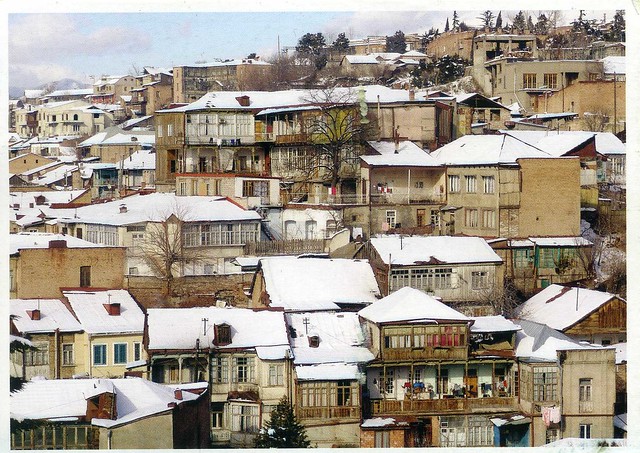
Just one more card for today. I thought this was sort of appropriate for today - a snowy view since we have snow here in England at the moment as well. Well, in this area at least - Matt's younger sister came over from London today and said there's no snow in London. No fair! :P
Anyway, this card is from a swap with Sini in Finland. Alas, it was sent from Finland but it's still precious to me, my first Georgian postcard. Apparently Tbilisi and Georgia are rather fascinating places to visit and yeah, it would be nice to go there and see it for myself.

Tbilisi is the capital and the largest city of Georgia, lying on the banks of the Kura River. The city covers an area of 726 km2 and has 1,480,000 inhabitants.
Founded in the 5th century by Vakhtang Gorgasali, the monarch of Georgia's precursor Kingdom of Iberia, Tbilisi has served, with various intervals, as Georgia's capital for nearly 1500 years and represents a significant industrial, social, and cultural center of the country. Located on the southeastern edge of Europe, Tbilisi's proximity to lucrative east-west trade routes often made the city a point of contention between various rival empires throughout history and the city's location to this day ensures its position as an important transit route for global energy and trade projects. Tbilisi's varied history is reflected in its architecture, which is a mix of medieval, classical, and Soviet structures.
Historically, Tbilisi has been home to peoples of diverse cultural, ethnic, and religious backgrounds, though it is now overwhelmingly Eastern Orthodox Christian. Notable tourist destinations include cathedrals like Sameba and Sioni, classical Freedom Square and Rustaveli Avenue, medieval Narikala Fortress, pseudo-Moorish Opera Theater, and the Georgian National Museum.
Anyway, this card is from a swap with Sini in Finland. Alas, it was sent from Finland but it's still precious to me, my first Georgian postcard. Apparently Tbilisi and Georgia are rather fascinating places to visit and yeah, it would be nice to go there and see it for myself.
Tbilisi is the capital and the largest city of Georgia, lying on the banks of the Kura River. The city covers an area of 726 km2 and has 1,480,000 inhabitants.
Founded in the 5th century by Vakhtang Gorgasali, the monarch of Georgia's precursor Kingdom of Iberia, Tbilisi has served, with various intervals, as Georgia's capital for nearly 1500 years and represents a significant industrial, social, and cultural center of the country. Located on the southeastern edge of Europe, Tbilisi's proximity to lucrative east-west trade routes often made the city a point of contention between various rival empires throughout history and the city's location to this day ensures its position as an important transit route for global energy and trade projects. Tbilisi's varied history is reflected in its architecture, which is a mix of medieval, classical, and Soviet structures.
Historically, Tbilisi has been home to peoples of diverse cultural, ethnic, and religious backgrounds, though it is now overwhelmingly Eastern Orthodox Christian. Notable tourist destinations include cathedrals like Sameba and Sioni, classical Freedom Square and Rustaveli Avenue, medieval Narikala Fortress, pseudo-Moorish Opera Theater, and the Georgian National Museum.
Subscribe to:
Posts (Atom)


Maroon