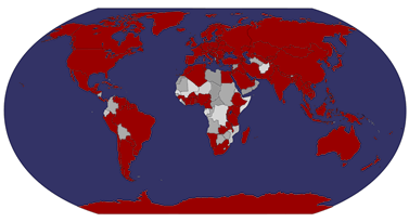
What does it say about this series that they aren't always even checked properly before going for printing, like here - one of the 'famous Latvians' is listed twice?! Unless I'm very much mistaken, a corrected issue was published later.. I've pretty much given up on trying to get the new issues as well because they all seem to be such hard-to-get countries and I'm not willing to pay ridiculous amounts for mint stamps/extra cards etc. Oh well, it was fun while it lasted. ....and I should still be getting the new special edition Finland card as I managed to arrange a swap for it. :)
This one is from a swap from two years ago.
I tried to find more information about this apparently very famous Arvīds Blūmentāls but Wikipedia doesn't have any information about them in English. ...and I'm too lazy to comment on anything else. :P
Showing posts with label 2015. Show all posts
Monday, 8 May 2017
Monday, 16 May 2016
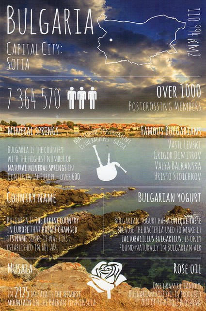
Greetings from Bulgaria
For some reason I thought I'd already posted about this card here. :o Nevermind... This is from a Facebook swap from last year. Another successful swap with Donka. :) Thank you so much!
This is one of the nicer cards in this series I think. I love the blue tones and the slightly darker colour - and the stormy-looking sky! :D I also love the fact that this card mentions Bulgarian yogurt. I really, really like it and tend to have at least some every time I go to Finland. For some reason I haven't been able to find it here in England (and Turkish yogurt seems impossible to find here as well for some reason, whereas it seems to be fairly popular in Finland). All you get here is Greek yogurt and while that's VERY nice as well, it's totally different. Bulgarian yogurt is a lot more sour I think (and yummy :)).
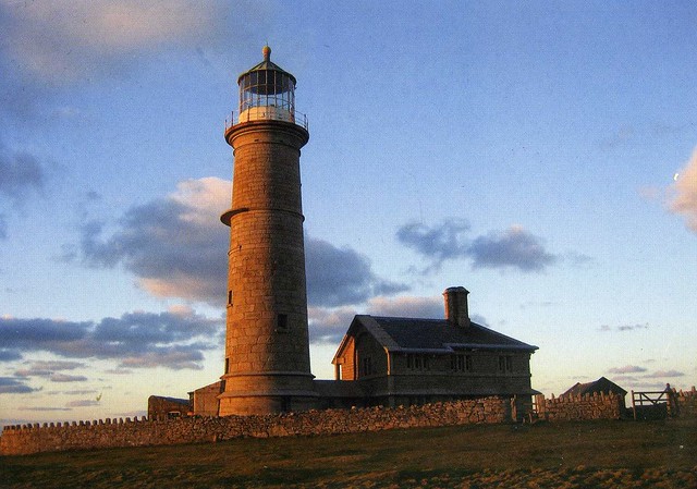
The Old Light, Lundy Island
This is the second postcard I received from the Lundy Island. I wrote about the first one here. I did want to post about this one as well. I don't think I could ever have too many lighthouse postcards. :D
Foundations for a lighthouse on Lundy were laid in 1787, but the first lighthouse (now known as the Old Light) was not built until Trinity House obtained a 999-year lease in 1819. The 30 m granite tower, on the summit of Chapel Hill, was designed by Daniel Asher Alexander, and built by Joseph Nelson at a cost of £36,000. Because the site, Beacon Hill, is 143 m above sea level, the highest base for a lighthouse in Britain, the light was often obscured by fog. To counter this problem, the Fog Signal Battery was built about 1861.
The lighthouse had two lights; the lower a fixed white light and the upper a quick flashing white light, showing every 60 seconds. However, this quick revolution gave the impression it was a fixed light with no flashes detectable. This may have contributed to the grounding, at Cefn Sidan, of the La Jeune Emma, bound from Martinique to Cherbourg in 1828. 13 of the 19 on board drowned, including Adeline Coquelin, the 12-year-old niece of Napoleon Bonaparte's divorced wife Joséphine de Beauharnais.
Owing to the ongoing complaints about the difficulty of sighting the light in fog, the lighthouse was abandoned in 1897 when the North and South Lundy lighthouses were built. The Old Light and the associated keepers' houses are kept open by the Landmark Trust.
Foundations for a lighthouse on Lundy were laid in 1787, but the first lighthouse (now known as the Old Light) was not built until Trinity House obtained a 999-year lease in 1819. The 30 m granite tower, on the summit of Chapel Hill, was designed by Daniel Asher Alexander, and built by Joseph Nelson at a cost of £36,000. Because the site, Beacon Hill, is 143 m above sea level, the highest base for a lighthouse in Britain, the light was often obscured by fog. To counter this problem, the Fog Signal Battery was built about 1861.
The lighthouse had two lights; the lower a fixed white light and the upper a quick flashing white light, showing every 60 seconds. However, this quick revolution gave the impression it was a fixed light with no flashes detectable. This may have contributed to the grounding, at Cefn Sidan, of the La Jeune Emma, bound from Martinique to Cherbourg in 1828. 13 of the 19 on board drowned, including Adeline Coquelin, the 12-year-old niece of Napoleon Bonaparte's divorced wife Joséphine de Beauharnais.
Owing to the ongoing complaints about the difficulty of sighting the light in fog, the lighthouse was abandoned in 1897 when the North and South Lundy lighthouses were built. The Old Light and the associated keepers' houses are kept open by the Landmark Trust.
Sunday, 1 May 2016
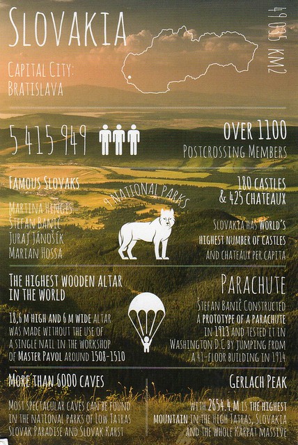
Greetings from Slovakia
Slovakia seems to be in the same category as South Africa in my postcard collection - I only have a few cards from there as well. This card is from an Instagram swap from last year.
Slovakia, officially the Slovak Republic, is a landlocked country in Central Europe. It is bordered by the Czech Republic and Austria to the west, Poland to the north, Ukraine to the east and Hungary to the south. Slovakia's territory spans about 49,000 square kilometres and is mostly mountainous. The population is over 5 million and comprises mostly ethnic Slovaks. The capital and largest city is Bratislava. The official language is Slovak, a member of the Slavic language family.
The Slavs arrived in the territory of present-day Slovakia in the 5th and 6th centuries. In the 7th century, they played a significant role in the creation of Samo's Empire and in the 9th century established the Principality of Nitra. In the 10th century, the territory was integrated into the Kingdom of Hungary, which itself became part of the Habsburg Empire and the Austro-Hungarian Empire. After World War I and the dissolution of the Austro-Hungarian Empire, the Slovaks and Czechs established Czechoslovakia. A separate Slovak Republic (1939–1945) existed in World War II as a client state of Nazi Germany. In 1945, Czechoslovakia was reestablished under communist rule as a Soviet satellite. Slovakia became an independent state on 1 January 1993 after the peaceful dissolution of Czechoslovakia.
Slovakia is a high-income advanced economy. The country joined the European Union in 2004 and the Eurozone on 1 January 2009. Slovakia is also a member of the Schengen Area, NATO, the United Nations, the OECD and the WTO.
Slovakia, officially the Slovak Republic, is a landlocked country in Central Europe. It is bordered by the Czech Republic and Austria to the west, Poland to the north, Ukraine to the east and Hungary to the south. Slovakia's territory spans about 49,000 square kilometres and is mostly mountainous. The population is over 5 million and comprises mostly ethnic Slovaks. The capital and largest city is Bratislava. The official language is Slovak, a member of the Slavic language family.
The Slavs arrived in the territory of present-day Slovakia in the 5th and 6th centuries. In the 7th century, they played a significant role in the creation of Samo's Empire and in the 9th century established the Principality of Nitra. In the 10th century, the territory was integrated into the Kingdom of Hungary, which itself became part of the Habsburg Empire and the Austro-Hungarian Empire. After World War I and the dissolution of the Austro-Hungarian Empire, the Slovaks and Czechs established Czechoslovakia. A separate Slovak Republic (1939–1945) existed in World War II as a client state of Nazi Germany. In 1945, Czechoslovakia was reestablished under communist rule as a Soviet satellite. Slovakia became an independent state on 1 January 1993 after the peaceful dissolution of Czechoslovakia.
Slovakia is a high-income advanced economy. The country joined the European Union in 2004 and the Eurozone on 1 January 2009. Slovakia is also a member of the Schengen Area, NATO, the United Nations, the OECD and the WTO.
The Postcrossing Association of Finland
A really interesting postcard I received last year. Not really so much the picture on it, but the story behind it and the reason for the card. Things like this make me miss Finland. :P
It seems fairly safe to say that Postcrossing is still pretty big in Finland when they now have a Postcrossing Association (Suomen Postcrossing-yhdistys). They have their own website (as far as I can tell, it's only in Finnish, though) and they seem fairly active. I'm pretty sure I'd be a member, too, if I still lived in Finland.
This card was sent from the association's constituent meeting, but it seems to have a been a meet-up as well as the card was signed by quite a few people.
It seems fairly safe to say that Postcrossing is still pretty big in Finland when they now have a Postcrossing Association (Suomen Postcrossing-yhdistys). They have their own website (as far as I can tell, it's only in Finnish, though) and they seem fairly active. I'm pretty sure I'd be a member, too, if I still lived in Finland.
This card was sent from the association's constituent meeting, but it seems to have a been a meet-up as well as the card was signed by quite a few people.
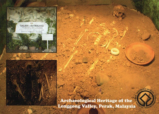
Archaeological Heritage of the Lenggong Valley, Malaysia
I've got a bit of a random mix of cards for today. This one is from a swap from last year.
Situated in the lush Lenggong Valley, the property includes four archaeological sites in two clusters which span close to 2 million years, one of the longest records of early man in a single locality, and the oldest outside the African continent. It features open-air and cave sites with Palaeolithic tool workshops, evidence of early technology. The number of sites found in the relatively contained area suggests the presence of a fairly large, semi-sedentary population with cultural remains from the Palaeolithic, Neolithic and Metal ages.
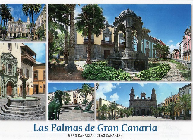
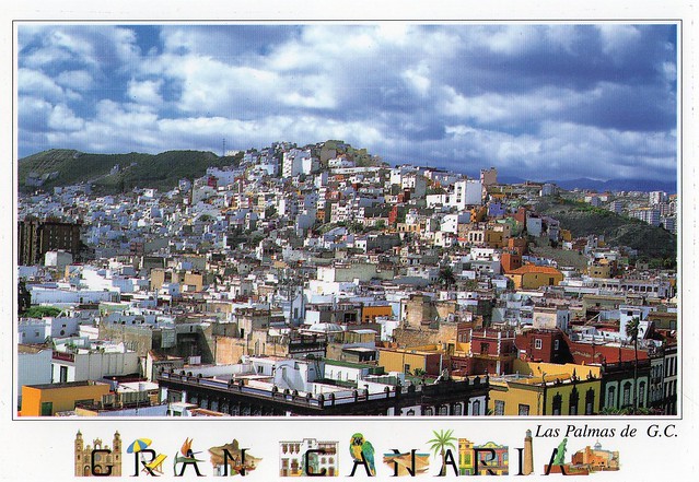
Las Palmas, Gran Canaria, Spain
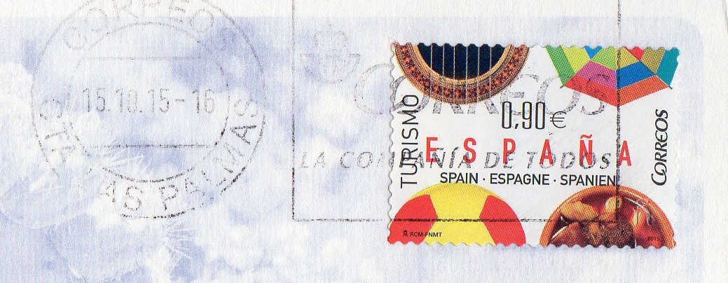
I've written about my holiday to Gran Canaria before here, but I bought quite a few postcards for myself to keep while there and wanted to post a couple more here. ...so here are two from Las Palmas. Matt and I did a day trip there during our holidays. Well, I say a day trip but really it only took about half a day. I could've spent so much longer there, it felt like we barely saw anything now apart from the old town. I remember our guide saying he wasn't that keen on Las Palmas as it's so much like any other city, but I don't agree. It certainly isn't anything like Birmingham. :P
It was founded as a city in 1478, considered the de facto only capital of the Canary Islands until the seventeenth century. Today, the city is capital of Canary Islands with Santa Cruz and home to the Canarian Ministry of Presidency (shared in a 4-year term with Santa Cruz de Tenerife), home to half of the Ministries and Boards of the Canarian Government, and home to the High Court of Justice of the Canary Islands. It is the judicial and commercial capital of the Canary Islands, and is also home to a great share of the executive power.
Las Palmas, officially Las Palmas de Gran Canaria, is a city and capital of Gran Canaria, in the Canary Islands. It is the co-capital (jointly with Santa Cruz de Tenerife) and the most populous city in the autonomous community of the Canary Islands, and the ninth largest city in Spain, with a population of 383,308 in 2010. Nearly half (45.9%) of the people of the island and 18.35% of all inhabitants of the Canary Islands live in this city. It is also the fifth most populous urban area in Spain with a population exceeding 700,000 and (depending on sources) ninth or tenth most populous metropolitan area in Spain with a population of between 625,000 and 750,000. Las Palmas is the largest city of the European Union lying outside the European Continent. It is located in the northeast part of the Spanish island of Gran Canaria, about 150 kilometres (93 miles) off the northwestern coast of Africa within the Atlantic Ocean.
Las Palmas enjoys a very mild and pleasant desertic climate (highly influenced by the Atlantic Ocean) with mild to warm temperatures throughout the year. Locals know it as the "Eternal Spring", with an average annual temperature of 21.3 °C. According to a study carried out by Thomas Whitmore, director of research on climatology at Syracuse University in the U.S., Las Palmas enjoys "the best climate in the world".
It was founded as a city in 1478, considered the de facto only capital of the Canary Islands until the seventeenth century. Today, the city is capital of Canary Islands with Santa Cruz and home to the Canarian Ministry of Presidency (shared in a 4-year term with Santa Cruz de Tenerife), home to half of the Ministries and Boards of the Canarian Government, and home to the High Court of Justice of the Canary Islands. It is the judicial and commercial capital of the Canary Islands, and is also home to a great share of the executive power.
Labels:
2015,
gran canaria,
holidays,
las palmas de gran canaria,
spain
Saturday, 30 April 2016
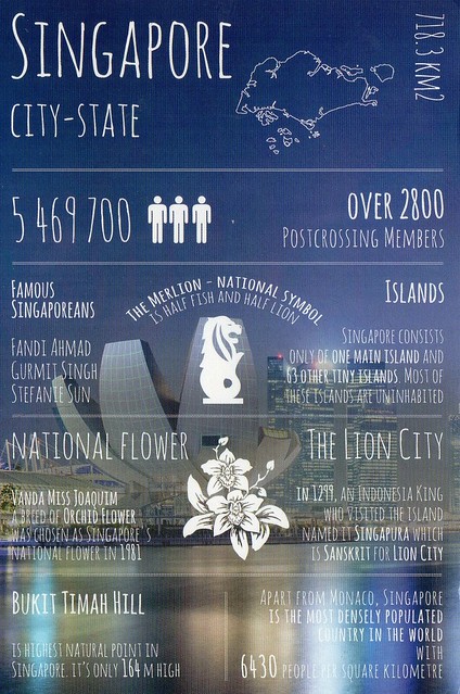
Greetings from Singapore
Today's Greetings from... postcard comes from Singapore. I'm not sure how I feel about this one, the blue and the gray seem a little cold to me...
The background picture here is the Art-Science Museum at Marina Bay area, a bay located in the Central Area of Singapore surrounded by the perimeter of four other planning areas, the Downtown Core, Marina East, Marina South and Straits View. The area surrounding the bay itself, also called Marina Bay, is a 360 hectare extension to the adjacent Central Business District.
I've got to admit, Singapore kind of fascinates me, I'd love to visit the country one day. I mean, I can't help wondering how it would be like to live in a country that basically comprises of one city?!
The background picture here is the Art-Science Museum at Marina Bay area, a bay located in the Central Area of Singapore surrounded by the perimeter of four other planning areas, the Downtown Core, Marina East, Marina South and Straits View. The area surrounding the bay itself, also called Marina Bay, is a 360 hectare extension to the adjacent Central Business District.
I've got to admit, Singapore kind of fascinates me, I'd love to visit the country one day. I mean, I can't help wondering how it would be like to live in a country that basically comprises of one city?!
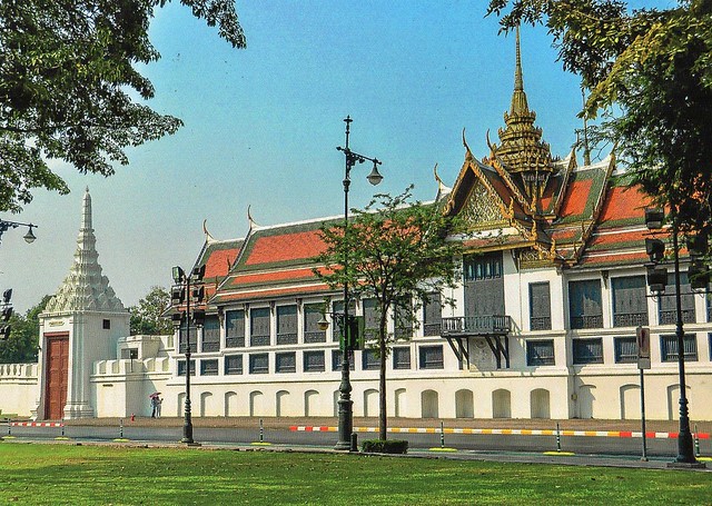
Bangkok, Thailand
May is almost here... it's May Day tomorrow! It's a little difficult to believe at the moment - we've had snow and hail stones a few times this week! :O I could understand that happening in Finland, but England?!? I'm not impressed, and not sure if it's because of the rubbish weather that I haven't been feeling too great for about a week now and have a sore throat. It's been feeling so raw at times that it's been painful to talk. :/ I've said this so many times but I certainly wouldn't mind being somewhere sunny and warm at the moment. :P ...such as Thailand, maybe? I received this card from Jobbo last year. Thank you ever so much for yet another great postcard!
I have no idea if this building is of any importance or what it's called.. There's no info on the back of the card. It does look pretty impressive.
Sunday, 3 April 2016
Greetings from New Zealand
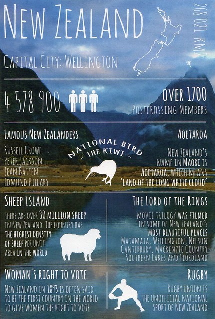
Just one more card for today, a 'greetings from' one from New Zealand.
Mentioning the Lord of the Rings movie trilogy was probably a very obvious choice here?? I do love the trilogy, they are some of my all-time favourite movies and I still remember when they came out and the anticipation for the next film... and then the extended edition dvd boxes and all the extras on those and watching them with friends. It almost got to the point where the extras were my favourite part :D Most dvds/blue rays still don't come anywhere close. Ahhh, good times! I'm getting nostalgic here... :p
I do wonder why the kiwi fruit isn't mentioned here.. but at least the sheep are included! ;)
Mentioning the Lord of the Rings movie trilogy was probably a very obvious choice here?? I do love the trilogy, they are some of my all-time favourite movies and I still remember when they came out and the anticipation for the next film... and then the extended edition dvd boxes and all the extras on those and watching them with friends. It almost got to the point where the extras were my favourite part :D Most dvds/blue rays still don't come anywhere close. Ahhh, good times! I'm getting nostalgic here... :p
I do wonder why the kiwi fruit isn't mentioned here.. but at least the sheep are included! ;)
Helsinki, Finland
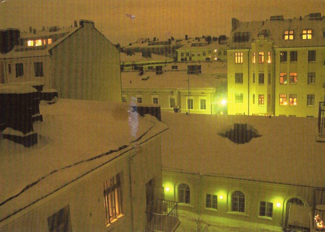
A lovely snowy view from Finland I received last year. I love the atmosphere here, it seems magical somehow.. and cozy at the same time.
The picture is from the Kruununhaka neighbourhood in southern Helsinki. It's one of the more affluent, fancy areas of Helsinki. According to Wikipedia, the area is known for its vintage shops??!
I LOVE the stamp! It was kind of why this swap got arranged in the first place... :D
The picture is from the Kruununhaka neighbourhood in southern Helsinki. It's one of the more affluent, fancy areas of Helsinki. According to Wikipedia, the area is known for its vintage shops??!
I LOVE the stamp! It was kind of why this swap got arranged in the first place... :D
Saturday, 26 March 2016
Ljubljana, Slovenia
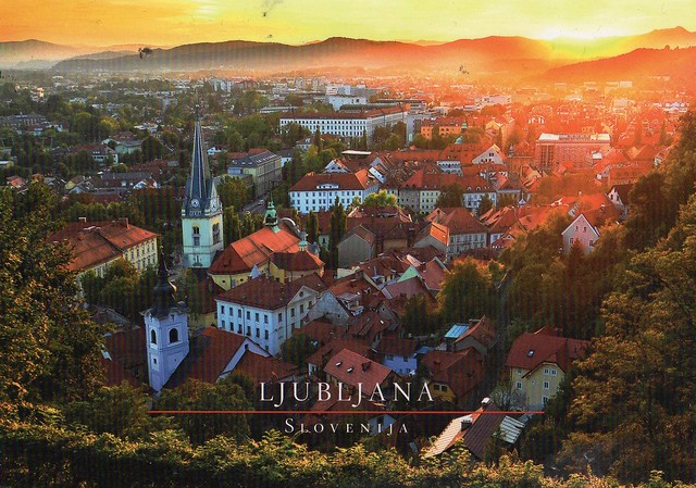
This is such an amazing view, I love this card! Ljubljana looks really idyllic anyway, and then you have this amazing light here. This card had been in my favourites for a while so I was really happy when Nusa offered to swap with me. ...and she used the Slovenian Postcrossing stamp on the card, too!
Ljubljana is the capital and largest city of Slovenia. During antiquity, it was the site of a Roman city called Emona. It was under Habsburg rule from the Middle Ages until the dissolution of the Austro-Hungarian Empire in 1918.
Situated at the middle of a trade route between the northern Adriatic Sea and the Danube region, it was the historical capital of Carniola, a Slovene-inhabited part of the Habsburg Monarchy, and it has been the cultural, educational, economic, political, and administrative center of independent Slovenia since 1991. Its central geographic location within Slovenia, transport connections, concentration of industry, scientific and research institutions and cultural tradition are contributing factors to its leading position.
The city's architecture is a mix of styles. Despite the appearance of large buildings, especially at the city's edge, Ljubljana's historic center remains intact. Although the oldest architecture has been preserved from the Roman period, Ljubljana's downtown got its outline in the Middle Ages. After the 1511 earthquake, it was rebuilt in the Baroque style following Italian, particularly Venetian, models. After the quake in 1895, it was once again rebuilt, this time in the Vienna Secession style, which today is juxtaposed against the earlier Baroque style buildings that remain. Large sectors built in the inter-war period often include a personal touch by the architects Jože Plečnik and Ivan Vurnik. In the second half of the 20th century, parts of Ljubljana were redesigned by Edvard Ravnikar.
Ljubljana is the capital and largest city of Slovenia. During antiquity, it was the site of a Roman city called Emona. It was under Habsburg rule from the Middle Ages until the dissolution of the Austro-Hungarian Empire in 1918.
Situated at the middle of a trade route between the northern Adriatic Sea and the Danube region, it was the historical capital of Carniola, a Slovene-inhabited part of the Habsburg Monarchy, and it has been the cultural, educational, economic, political, and administrative center of independent Slovenia since 1991. Its central geographic location within Slovenia, transport connections, concentration of industry, scientific and research institutions and cultural tradition are contributing factors to its leading position.
The city's architecture is a mix of styles. Despite the appearance of large buildings, especially at the city's edge, Ljubljana's historic center remains intact. Although the oldest architecture has been preserved from the Roman period, Ljubljana's downtown got its outline in the Middle Ages. After the 1511 earthquake, it was rebuilt in the Baroque style following Italian, particularly Venetian, models. After the quake in 1895, it was once again rebuilt, this time in the Vienna Secession style, which today is juxtaposed against the earlier Baroque style buildings that remain. Large sectors built in the inter-war period often include a personal touch by the architects Jože Plečnik and Ivan Vurnik. In the second half of the 20th century, parts of Ljubljana were redesigned by Edvard Ravnikar.
Greetings from Malaysia
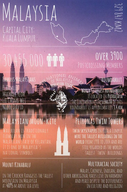
Now, I honestly thought I'd already posted about this card in this blog. Turns out I haven't... hhmmmm. I ended up receiving two copies of this card, too, and I'll include the stamps of both of them here as they are both really nice, and one of them has really nice decorations on the back as well. I kind of wish I had that much inspiration when writing my cards!
Matthew points out that Malaysia is the only country that has land on both mainland Asia and Malay archipelago. It does make for a pretty interesting map!
I also love the bit about multiracial society here. I was talking to my parents in Finland yesterday and some of the things we discussed made me pretty sad. I'd already read some of it in the news and just can't believe some people would be so horrible. Some Finns (and other nationals) could learn a thing or a few from Malaysia!
The stamps on the first card (from Matthew)...
...and the back of the second card. Isn't this lovely?!
Matthew points out that Malaysia is the only country that has land on both mainland Asia and Malay archipelago. It does make for a pretty interesting map!
I also love the bit about multiracial society here. I was talking to my parents in Finland yesterday and some of the things we discussed made me pretty sad. I'd already read some of it in the news and just can't believe some people would be so horrible. Some Finns (and other nationals) could learn a thing or a few from Malaysia!
The stamps on the first card (from Matthew)...
...and the back of the second card. Isn't this lovely?!
Thursday, 24 March 2016
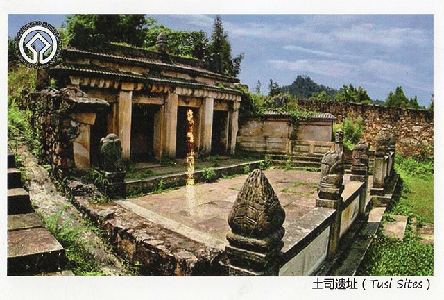
Tusi Sites, China
Tusi Sites is the most recent Unesco site in China. I received this postcard from a swap last year.
Distributed around the mountainous areas of south-west China are the remains of tribal domains whose leaders were appointed by the central government as ‘Tusi’, hereditary rulers of their regions from the 13th to the early 20th century. This system of administrative government was aimed at unifying national administration while simultaneously allowing ethnic minorities to retain their customs and way of life. The three sites of Laosicheng, Tangya and the Hailongtun Fortress combine as a serial property to represent this system of governance. The archaeological sites and standing remains of Laosicheng Tusi Domain and Hailongtun Fortress represent domains of highest ranking Tusi; the Memorial Archway and remains of the Administration Area, boundary walls, drainage ditches and tombs at Tangya Tusi Domain represent the domain of a lower ranked Tusi. Their combinations of local ethnic and central Chinese features exhibit an interchange of values and testify to imperial Chinese administrative methods, while retaining their association with the living cultural traditions of the ethnic minority groups represented by the cultural traditions and practices of the Tujia communities at Laosicheng.
Inge Löök's grannies
I'm mainly including this card here because of the stamp and theh cancellation, although the card itself is lovely, too. This is from a Facebook swap with Marko in Finland last year. He seems to have access to some pretty awesome postcards and stamps (and special cancellations... again, I so wish I could get them here, too!).
I love the atmosphere in this card. So cheerful, relaxed and summery. Summer, hurry up! ...and be nice and warm as well! :P
One of my favourite bands on a stamp!
I love the atmosphere in this card. So cheerful, relaxed and summery. Summer, hurry up! ...and be nice and warm as well! :P
One of my favourite bands on a stamp!
Sunday, 13 March 2016
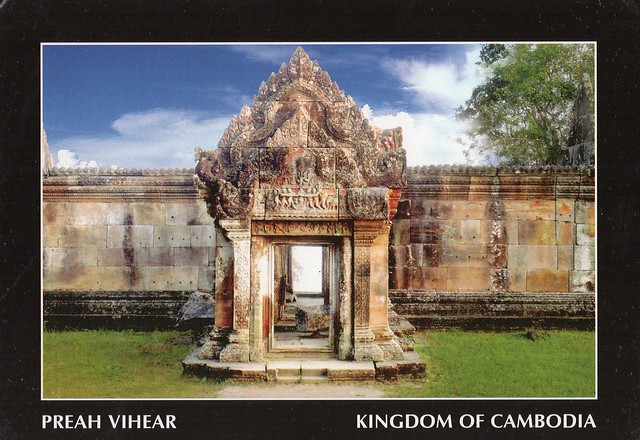
Temple of Preah Vihear, Cambodia
Today seems to be all about postcards I received in 2015. :P It really wasn't intentional, I always just tend to pick a few random cards from a pile I've put aside that I want to blog about. Anyway, this was quite a treat as well and I was really happy when Ave agreed to swap with me. It's not like I receive postcards from Cambodia every other week. :P
Situated on the edge of a plateau that dominates the plain of Cambodia, the Temple of Preah Vihear is dedicated to Shiva. The Temple is composed of a series of sanctuaries linked by a system of pavements and staircases over an 800 metre long axis and dates back to the first half of the 11th century AD. Nevertheless, its complex history can be traced to the 9th century, when the hermitage was founded. This site is particularly well preserved, mainly due to its remote location. The site is exceptional for the quality of its architecture, which is adapted to the natural environment and the religious function of the temple, as well as for the exceptional quality of its carved stone ornamentation.
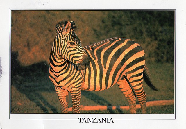
Tarangire National Park, Tanzania
Yet another postcard from last year. I think this is only about my second postcard received from Tanzania, sent by Xindi who was volunteering in Tanzania. It must have been quite an experience...!
Tarangire National Park is the sixth largest national park in Tanzania after Ruaha, Serengeti, Mikumi, Katavi and Mkomazi. The national park is located in Manyara Region. The name of the park originates from the Tarangire river that crosses through the park, being the only source of water for wild animals during dry seasons. During the dry season thousands of animals migrate to the Tarangire National Park from Manyara National Park.
It lies a little distance to the south east of Lake Manyara and covers an area of approximately 2,850 square kilometers. The landscape and vegetation is incredibly diverse with a mix that is not found anywhere else in the northern safari circuit. The hilly landscape is dotted with vast numbers of Baobab trees, dense bush and high grasses.
The park is famous for its huge number of elephants, baobab trees and tree climbing lions. Visitors to the park can expect to see any number of resident zebra and wildebeest in addition to the less common animals. Other common animals include waterbuck, giraffe, and olive baboons.
Home to more than 550 species, the park is a haven for bird enthusiasts who can expect so see dozens of species even in the dry season. The swamps are the focus of the largest selection of breeding birds anywhere in the world. yellow-collared lovebirds are a common bird sighting in the trees along the Tarangire River.
The park is also famous for the termite mounds that dot the landscape. Those that have been abandoned are often seen to be home to dwarf mongoose.
In 2015, a giraffe that is white due to leucism was spotted in the park.
Tarangire National Park is the sixth largest national park in Tanzania after Ruaha, Serengeti, Mikumi, Katavi and Mkomazi. The national park is located in Manyara Region. The name of the park originates from the Tarangire river that crosses through the park, being the only source of water for wild animals during dry seasons. During the dry season thousands of animals migrate to the Tarangire National Park from Manyara National Park.
It lies a little distance to the south east of Lake Manyara and covers an area of approximately 2,850 square kilometers. The landscape and vegetation is incredibly diverse with a mix that is not found anywhere else in the northern safari circuit. The hilly landscape is dotted with vast numbers of Baobab trees, dense bush and high grasses.
The park is famous for its huge number of elephants, baobab trees and tree climbing lions. Visitors to the park can expect to see any number of resident zebra and wildebeest in addition to the less common animals. Other common animals include waterbuck, giraffe, and olive baboons.
Home to more than 550 species, the park is a haven for bird enthusiasts who can expect so see dozens of species even in the dry season. The swamps are the focus of the largest selection of breeding birds anywhere in the world. yellow-collared lovebirds are a common bird sighting in the trees along the Tarangire River.
The park is also famous for the termite mounds that dot the landscape. Those that have been abandoned are often seen to be home to dwarf mongoose.
In 2015, a giraffe that is white due to leucism was spotted in the park.
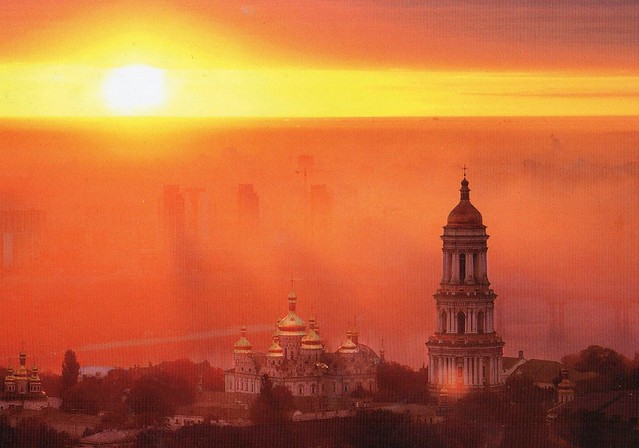
Kiev Pechersk Lavra, Ukraine
Another postcard from last year. This is a Unesco site, too, but I love it more for its colours and the atmosphere - and there's a Postcrossing stamp and a special cancellation on it, and those were actually the main point of this card. Postcrossing stamps are such a cool idea, I wish the Royal Mail would issue one as well but apparently they won't even consider it. :( ...and the Netherlands are going to get a SECOND set later this month!
Kyiv Pechersk Lavra, also known as the Kiev Monastery of the Caves, is a historic Orthodox Christian monastery which gave its name to one of the city districts where it is located in Kiev.
Since its foundation as the cave monastery in 1051 the Lavra has been a preeminent center of Eastern Orthodox Christianity in Eastern Europe. Together with the Saint Sophia Cathedral, it is inscribed as a UNESCO World Heritage Site. The monastery complex is considered a separate national historic-cultural preserve (sanctuary), the national status to which was granted on 13 March 1996. The Lavra is not only located in another part of the city, but is part of a different national sanctuary than Saint Sophia Cathedral. While being a cultural attraction, the monastery is currently active. It was named one of the Seven Wonders of Ukraine on 21 August 2007, based on voting by experts and the internet community.
Kyiv Pechersk Lavra, also known as the Kiev Monastery of the Caves, is a historic Orthodox Christian monastery which gave its name to one of the city districts where it is located in Kiev.
Since its foundation as the cave monastery in 1051 the Lavra has been a preeminent center of Eastern Orthodox Christianity in Eastern Europe. Together with the Saint Sophia Cathedral, it is inscribed as a UNESCO World Heritage Site. The monastery complex is considered a separate national historic-cultural preserve (sanctuary), the national status to which was granted on 13 March 1996. The Lavra is not only located in another part of the city, but is part of a different national sanctuary than Saint Sophia Cathedral. While being a cultural attraction, the monastery is currently active. It was named one of the Seven Wonders of Ukraine on 21 August 2007, based on voting by experts and the internet community.
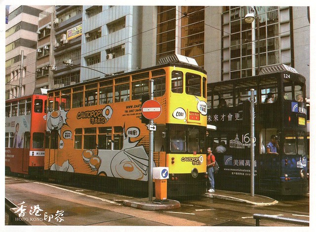
Hong Kong tram
A very nice official Postcrossing card from last year... I didn't even send that many officials last year.. I've been sending them a little bit more this year as I've received so many nice ones and I love the randomness of the official Postcrossing, but will have to cut back again as stamp prices will go up again at the end of this month. :( £1.05 is a bit much to send a postcard I think... :/
HK-330983
Hong Kong trams fascinate me. I love the ones with illustrations like this. And well, I love trams in general :P
This card arrived in an envelope - the sender also included a big map of Hong Kong which I find very cool. I've got a bit of a thing for maps as well... :)
Hong Kong trams fascinate me. I love the ones with illustrations like this. And well, I love trams in general :P
This card arrived in an envelope - the sender also included a big map of Hong Kong which I find very cool. I've got a bit of a thing for maps as well... :)
Wednesday, 2 March 2016
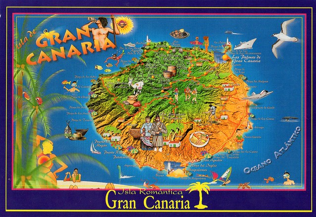
Gran Canaria, Canary Islands, Spain
I was supposed to post about this card a lot earlier... I sent this card to myself last October, from my holiday to Gran Canaria. It was such a lovely holiday, too, and it was great to be somewhere so sunny and warm for a chance (and I miss it again... we had sleet here in England today! :o). It was a bit of a last-minute decision, too, as my husband and I hadn't been planning on travelling abroad last year, but then my husband decided he wanted to go somewhere warm on his holiday. Not that I minded ;)
I was quite surprised to see how diverse Gran Canaria actually is - I'm embarrassed to admit this but I hadn't realised how mountainous the island is as I'd mainly just seen photos of the beaches before :p We attended an all-day island tour and it was quite possibly my favourite part of the holiday - I loved seeing different places on the island. Some of the really inland areas actually reminded me of Finland a bit, what with all the pine trees and rugged landscape!
There are a LOT of photos from my holiday here if you want to take a look.
Gran Canaria is the second most populous island of the Canary Islands, a Spanish archipelago, with a population of 838,397 which constitutes approximately 40% of the population of the archipelago. Located in the Atlantic Ocean about 150 kilometres off the northwestern coast of Africa and about 1,350 km from Europe.
Gran Canaria was populated by the Canarii, who may have arrived as early as 500 BC. The Canarii called the island Tamarán or Land of the Brave. After over a century of European (French, Portuguese...) incursions and attempts at conquest, the island was conquered on April 29, 1483, after a campaign that lasted five years, by the Crown of Castile, with the support of Queen Isabella I, a conquest which turned out to be an important step towards the expansion of the unified Spain.
The capital city of Las Palmas de Gran Canaria was founded on June 24, 1478, under the name "Real de Las Palmas", by Juan Rejón, head of the invading Castilian army. In 1492, Christopher Columbus anchored in the Port of Las Palmas (and spent some time on the island) on his first trip to the Americas. Las Palmas de Gran Canaria is, jointly with Santa Cruz de Tenerife, the capital of the autonomous community of the Canary Islands.
Gran Canaria is located southeast of Tenerife and west of Fuerteventura. The island is of volcanic origin, mostly made of fissure vents. Gran Canaria's surface area is 1,560 km² and its maximum elevation is 1,949 meters (Pico de Las Nieves). It has a round shape, with a diameter of approximately 50 km.
Gran Canaria is noted for its rich variety of microclimates. Generally speaking though, the average daytime high ranges from 20 °C in winter, to 26 °C in summer. Some cool nights occur in winter, but lows below 10 °C are unknown near the coast. Inland the climate is still mild but mountainous areas see the occasional frost or snow. Annual rainfall averages 228 mm, most of this falling in the cooler months, with July, August and September normally rainless. Rainfall is unevenly distributed through the island with some areas being much drier than others. Cloud cover and sunshine is often quite variable during the cooler months, and there can be several rather cloudy days at times in winter. Summers are generally quite sunny however, with the south of the island being most favoured.
This island is called a "Miniature Continent" due to the different climates and variety of landscapes found, with long beaches and dunes of white sand, contrasting with green ravines and picturesque villages. A third of the island is under protection as a Biosphere Reserve by UNESCO.
The number of annual visitors is 2.2 million. Most of the tourists visit the southern part of the island. The north tends to be cooler, while the south is warmer and sunny. The east coast of the island is flat, dotted with beaches, while the western coast is rockier and mountainous.
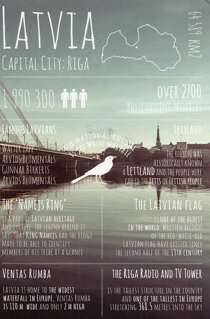
I was quite surprised to see how diverse Gran Canaria actually is - I'm embarrassed to admit this but I hadn't realised how mountainous the island is as I'd mainly just seen photos of the beaches before :p We attended an all-day island tour and it was quite possibly my favourite part of the holiday - I loved seeing different places on the island. Some of the really inland areas actually reminded me of Finland a bit, what with all the pine trees and rugged landscape!
There are a LOT of photos from my holiday here if you want to take a look.
Gran Canaria is the second most populous island of the Canary Islands, a Spanish archipelago, with a population of 838,397 which constitutes approximately 40% of the population of the archipelago. Located in the Atlantic Ocean about 150 kilometres off the northwestern coast of Africa and about 1,350 km from Europe.
Gran Canaria was populated by the Canarii, who may have arrived as early as 500 BC. The Canarii called the island Tamarán or Land of the Brave. After over a century of European (French, Portuguese...) incursions and attempts at conquest, the island was conquered on April 29, 1483, after a campaign that lasted five years, by the Crown of Castile, with the support of Queen Isabella I, a conquest which turned out to be an important step towards the expansion of the unified Spain.
The capital city of Las Palmas de Gran Canaria was founded on June 24, 1478, under the name "Real de Las Palmas", by Juan Rejón, head of the invading Castilian army. In 1492, Christopher Columbus anchored in the Port of Las Palmas (and spent some time on the island) on his first trip to the Americas. Las Palmas de Gran Canaria is, jointly with Santa Cruz de Tenerife, the capital of the autonomous community of the Canary Islands.
Gran Canaria is located southeast of Tenerife and west of Fuerteventura. The island is of volcanic origin, mostly made of fissure vents. Gran Canaria's surface area is 1,560 km² and its maximum elevation is 1,949 meters (Pico de Las Nieves). It has a round shape, with a diameter of approximately 50 km.
Gran Canaria is noted for its rich variety of microclimates. Generally speaking though, the average daytime high ranges from 20 °C in winter, to 26 °C in summer. Some cool nights occur in winter, but lows below 10 °C are unknown near the coast. Inland the climate is still mild but mountainous areas see the occasional frost or snow. Annual rainfall averages 228 mm, most of this falling in the cooler months, with July, August and September normally rainless. Rainfall is unevenly distributed through the island with some areas being much drier than others. Cloud cover and sunshine is often quite variable during the cooler months, and there can be several rather cloudy days at times in winter. Summers are generally quite sunny however, with the south of the island being most favoured.
This island is called a "Miniature Continent" due to the different climates and variety of landscapes found, with long beaches and dunes of white sand, contrasting with green ravines and picturesque villages. A third of the island is under protection as a Biosphere Reserve by UNESCO.
The number of annual visitors is 2.2 million. Most of the tourists visit the southern part of the island. The north tends to be cooler, while the south is warmer and sunny. The east coast of the island is flat, dotted with beaches, while the western coast is rockier and mountainous.
Labels:
2015,
canary islands,
gran canaria,
holidays,
maps,
spain
Subscribe to:
Posts (Atom)


Maroon