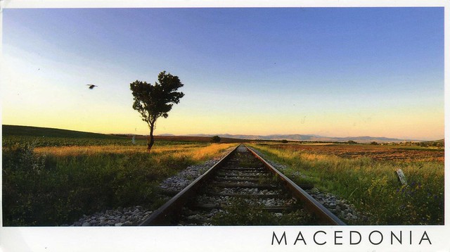
Train tracks fading to the distance... I'd like to travel somewhere too... :P Well, I'll be going to London next month to see my sister but it won't exactly be as peaceful and tranquil as this. :P This is such a lovely view, too, one of my favourites from Macedonia, received from dear Ana.
Ovče Pole is a plain situated around the flow of Sveti Nikole's River, which is a tributary to the Bregalnica river, in the east-central part of Republic of Macedonia. The climate of the plain is characterized by hot and dry summers and temperately cold winters, with occasional sharp lows. The highest registered temperature in the plain was 44.0C and the lowest registered temperature was -23.0C.
Strong winds from the north-west, north, south-east are specific for this region and are present for most of the year, this being the reason the area to be called "the windiest place on the Balkans". The Ovče Pole plain is one of the driest areas in Europe and is plagued by frequent drought periods. The yearly average of rainfall is in the 400-500 ml/m2 range. The average elevation of the plain is 200–400 m, and the highest place is Gjurište, with an elevation of 856m above sea level. In the region of Alin Dol of the river Mavrovica, in 1981, an artificial dam was built. Its water is used for the water supply of the city of Sveti Nikole.
Showing posts with label 2011. Show all posts
Wednesday, 11 March 2015
Friday, 20 February 2015
Ethiopia
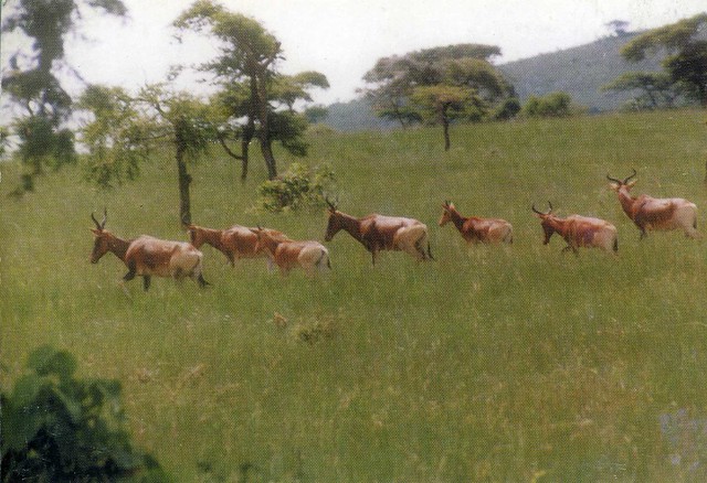
A very nice postcard I received from Ethiopia a few years ago.

The animal here is Swayne's hartebeest, an endangered antelope native to Ethiopia. Two of the largest remaining populations are located in Senkelle Swayne's Hartebeest Sanctuary and Maze National Park.
Now, this card actually arrived from a recipe RR on the Postcrossing forum. The sender, Chitra Nair, included a recipe for 'rajma', kidney beans in yoghurt curry. I have to confess I still haven't tried it - at the time of receiving the card I didn't really like beans, but I've since learned to eat them (well, not all of them, but a lot of them anyway) so I could actually try this as it sounds quite nice. There seem to be a lot of recipes for this online, too, such as this one.

The animal here is Swayne's hartebeest, an endangered antelope native to Ethiopia. Two of the largest remaining populations are located in Senkelle Swayne's Hartebeest Sanctuary and Maze National Park.
Now, this card actually arrived from a recipe RR on the Postcrossing forum. The sender, Chitra Nair, included a recipe for 'rajma', kidney beans in yoghurt curry. I have to confess I still haven't tried it - at the time of receiving the card I didn't really like beans, but I've since learned to eat them (well, not all of them, but a lot of them anyway) so I could actually try this as it sounds quite nice. There seem to be a lot of recipes for this online, too, such as this one.
Sunday, 15 February 2015
Zagreb, Croatia
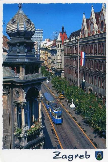
A lovely view of Zagreb I received from dear Nives a few years ago.
This is one of my favourite received views of Zagreb. The blue tram might have something to do with that... :) The building on the right is the central postal building in Zagreb.
By the way, if you want to see more nice views of Zagreb (and other places in Croatia), check out Nives's instagram. If only photos like that were turned into postcards, too....!
This is one of my favourite received views of Zagreb. The blue tram might have something to do with that... :) The building on the right is the central postal building in Zagreb.
By the way, if you want to see more nice views of Zagreb (and other places in Croatia), check out Nives's instagram. If only photos like that were turned into postcards, too....!
Sunday, 1 February 2015
Madinat Jumeirah and Burj Al Arab, Dubai
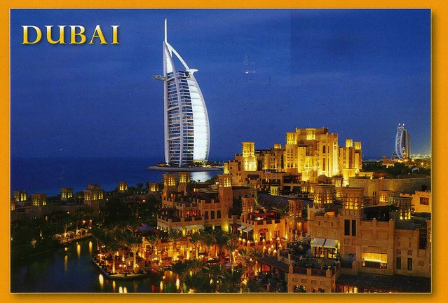
I was supposed to go to an Aikido class in Birmingham this morning with Matt, but he's not feeling too well and I'm not exactly feeling too great either - I hope I haven't caught the cold as well. :/ Anyway, I thought I'd post a few cards here instead. The first one is from a swap a few years ago, and still one of my only postcards from Dubai.
Madinat Jumeirah the Arabian Resort - Dubai, is a luxurious 5 star resort in Dubai and is also the largest resort in the emirate, spreading across over 40 hectares of landscapes and gardens. It is designed to resemble a traditional Arabian town. The resort comprises two boutique hotels (Al Qasr and Mina A'Salam) and a courtyard of 29 summer houses called Dar Al Masyaf. The resort has over 40 restaurants and bars.
Madinat Jumeirah is located along one kilometre of private beachfront adjacent to Jumeirah Beach Hotel, Burj Al Arab, and Wild Wadi Water Park. It is an approximate 30 minute drive from Dubai International Airport in non-peak traffic.
Madinat Jumeirah the Arabian Resort - Dubai, is a luxurious 5 star resort in Dubai and is also the largest resort in the emirate, spreading across over 40 hectares of landscapes and gardens. It is designed to resemble a traditional Arabian town. The resort comprises two boutique hotels (Al Qasr and Mina A'Salam) and a courtyard of 29 summer houses called Dar Al Masyaf. The resort has over 40 restaurants and bars.
Madinat Jumeirah is located along one kilometre of private beachfront adjacent to Jumeirah Beach Hotel, Burj Al Arab, and Wild Wadi Water Park. It is an approximate 30 minute drive from Dubai International Airport in non-peak traffic.
Saturday, 13 December 2014
Miradouro de Leba, Huila, Angola
A new country to my collection! Well, this one wasn't actually mailed from Angola but since the chances of ever receiving a postcard from there are pretty slim, I'm more than happy with this one. It's such a nice view, too!
Angola, officially the Republic of Angola, is a country in Southern Africa. It is the seventh largest country in Africa, and is bordered by Namibia on the south, the Democratic Republic of the Congo on the north, and Zambia on the east; its west coast is on the Atlantic Ocean and Luanda is its capital city. The exclave province of Cabinda has borders with the Republic of the Congo and the Democratic Republic of the Congo.
The Portuguese were present in some – mostly coastal – points of the territory of what is now Angola, from the 16th to the 19th century, interacting in diverse ways with the peoples who lived there. In the 19th century, they slowly and hesitantly began to establish themselves in the interior. Angola as a Portuguese colony encompassing the present territory was not established before the end of the 19th century, and "effective occupation", as required by the Berlin Conference (1884) was achieved only by the 1920s after the Mbunda resistance and abduction of their King, Mwene Mbandu I Lyondthzi Kapova. Independence was achieved in 1975, after a protracted liberation war. After independence, Angola was the scene of an intense civil war from 1975 to 2002. Despite the civil war, areas such as Baixa de Cassanje continue a lineage of kings which have included the former King Kambamba Kulaxingo and current King Dianhenga Aspirante Mjinji Kulaxingo.
The country has vast mineral and petroleum reserves, and its economy has on average grown at a double-digit pace since the 1990s, especially since the end of the civil war. In spite of this, standards of living remain low for the majority of the population, and life expectancy and infant mortality rates in Angola are among the worst in the world. Angola is considered to be economically disparate, with the majority of the nation's wealth concentrated in a disproportionately small sector of the population.
Angola is a member state of the United Nations, OPEC, African Union, the Community of Portuguese Language Countries, the Latin Union and the Southern African Development Community.
Huíla, then, is a province of Angola. It has an area of 79,023 square kilometres and a population of 2,354,398 (2014 census). Lubango is the capital of the province. Basket-making is a significant industry in the province; many make baskets out of reeds.
Angola, officially the Republic of Angola, is a country in Southern Africa. It is the seventh largest country in Africa, and is bordered by Namibia on the south, the Democratic Republic of the Congo on the north, and Zambia on the east; its west coast is on the Atlantic Ocean and Luanda is its capital city. The exclave province of Cabinda has borders with the Republic of the Congo and the Democratic Republic of the Congo.
The Portuguese were present in some – mostly coastal – points of the territory of what is now Angola, from the 16th to the 19th century, interacting in diverse ways with the peoples who lived there. In the 19th century, they slowly and hesitantly began to establish themselves in the interior. Angola as a Portuguese colony encompassing the present territory was not established before the end of the 19th century, and "effective occupation", as required by the Berlin Conference (1884) was achieved only by the 1920s after the Mbunda resistance and abduction of their King, Mwene Mbandu I Lyondthzi Kapova. Independence was achieved in 1975, after a protracted liberation war. After independence, Angola was the scene of an intense civil war from 1975 to 2002. Despite the civil war, areas such as Baixa de Cassanje continue a lineage of kings which have included the former King Kambamba Kulaxingo and current King Dianhenga Aspirante Mjinji Kulaxingo.
The country has vast mineral and petroleum reserves, and its economy has on average grown at a double-digit pace since the 1990s, especially since the end of the civil war. In spite of this, standards of living remain low for the majority of the population, and life expectancy and infant mortality rates in Angola are among the worst in the world. Angola is considered to be economically disparate, with the majority of the nation's wealth concentrated in a disproportionately small sector of the population.
Angola is a member state of the United Nations, OPEC, African Union, the Community of Portuguese Language Countries, the Latin Union and the Southern African Development Community.
Huíla, then, is a province of Angola. It has an area of 79,023 square kilometres and a population of 2,354,398 (2014 census). Lubango is the capital of the province. Basket-making is a significant industry in the province; many make baskets out of reeds.
Saturday, 29 November 2014
Andorra
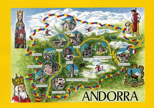
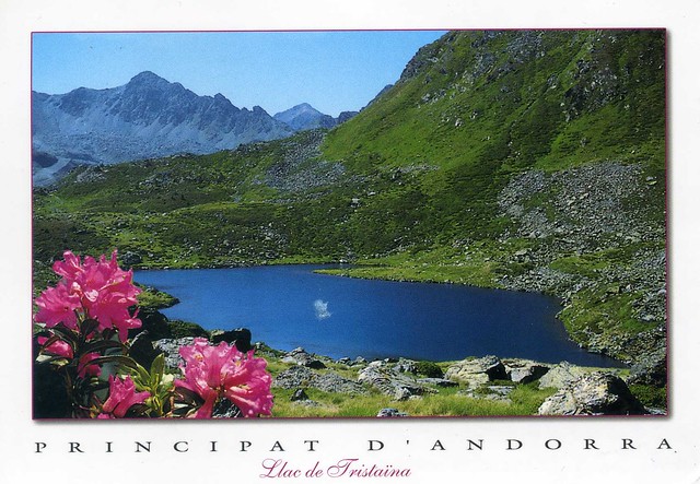
Andorra is one of those countries where I only have about three cards from. I just realised I hadn't posted any here yet so here are a couple of them. The first one is from a swap, the second one from a RR on the Postcrossing forum.
Andorra, officially the Principality of Andorra, also called the Principality of the Valleys of Andorra, is a sovereign landlocked microstate in Southwestern Europe, located in the eastern Pyrenees mountains and bordered by Spain and France. It is the sixth smallest nation in Europe, having an area of 468 km2 and an estimated population of 85,000 in 2012. Its capital, Andorra la Vella, is the highest capital city in Europe, at an elevation of 1,023 metres above sea level. The official language is Catalan, although Spanish, Portuguese, and French are also commonly spoken.
Created under a charter in A.D. 988, the present Principality was formed in A.D. 1278. It is known as a principality as it is a monarchy headed by two Co-Princes – the Spanish/Roman Catholic Bishop of Urgell and the President of France.
Andorra is a prosperous country, mainly because of its tourism industry, which services an estimated 10.2 million visitors annually, and because of its status as a tax haven, although it is in the process of reforming its tax regime. It is not a member of the European Union, but the euro is the de facto currency. It has been a member of the United Nations since 1993. The people of Andorra have the 2nd highest human life expectancy at birth in the world – 84 years.
Andorra has two postal systems, the Spanish and the French one. These stamps are from the Spanish post...
I'm not sure of the exact location of this place, it only says 'Valls d'Andorra' on the back of the card.
... and these stamps are from the French post.
Andorra, officially the Principality of Andorra, also called the Principality of the Valleys of Andorra, is a sovereign landlocked microstate in Southwestern Europe, located in the eastern Pyrenees mountains and bordered by Spain and France. It is the sixth smallest nation in Europe, having an area of 468 km2 and an estimated population of 85,000 in 2012. Its capital, Andorra la Vella, is the highest capital city in Europe, at an elevation of 1,023 metres above sea level. The official language is Catalan, although Spanish, Portuguese, and French are also commonly spoken.
Created under a charter in A.D. 988, the present Principality was formed in A.D. 1278. It is known as a principality as it is a monarchy headed by two Co-Princes – the Spanish/Roman Catholic Bishop of Urgell and the President of France.
Andorra is a prosperous country, mainly because of its tourism industry, which services an estimated 10.2 million visitors annually, and because of its status as a tax haven, although it is in the process of reforming its tax regime. It is not a member of the European Union, but the euro is the de facto currency. It has been a member of the United Nations since 1993. The people of Andorra have the 2nd highest human life expectancy at birth in the world – 84 years.
Andorra has two postal systems, the Spanish and the French one. These stamps are from the Spanish post...
I'm not sure of the exact location of this place, it only says 'Valls d'Andorra' on the back of the card.
... and these stamps are from the French post.
Sunday, 17 August 2014
Niigata, Japan
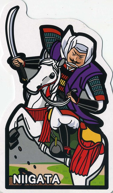
There has been a fair bit of discussion about 'Gotochi' postcards on the Postcrossing forum and I don't really have anything to add. I do really like this series, it's a shame the postcards are so expensive and hard to get, though. I've managed to get a few, this one is probably my favourite as I find samurai pretty fascinating.
This postcard is from Niigata Prefecture, a prefecture of Japan located on the island of Honshū on the coast of the Sea of Japan. The capital is the city of Niigata with which it shares the same name. The name "Niigata" literally means "new lagoon".
Until after the Meiji Restoration, the area that is now Niigata Prefecture was divided into Echigo Province and Sado Province. During the Sengoku period, the Nagao clan, who were at times vassals to the Uesugi, ruled a fief in the western part of modern Niigata from Kasugayama Castle. The most notable member of the Nagao clan was Nagao Kagetora, later and better known as Uesugi Kenshin. He unified the leaders of Echigo Province and became its sole ruler. By taking the surname Uesugi, he also became the head of the Uesugi clan and effectively brought their realm under his control.
This postcard is from Niigata Prefecture, a prefecture of Japan located on the island of Honshū on the coast of the Sea of Japan. The capital is the city of Niigata with which it shares the same name. The name "Niigata" literally means "new lagoon".
Until after the Meiji Restoration, the area that is now Niigata Prefecture was divided into Echigo Province and Sado Province. During the Sengoku period, the Nagao clan, who were at times vassals to the Uesugi, ruled a fief in the western part of modern Niigata from Kasugayama Castle. The most notable member of the Nagao clan was Nagao Kagetora, later and better known as Uesugi Kenshin. He unified the leaders of Echigo Province and became its sole ruler. By taking the surname Uesugi, he also became the head of the Uesugi clan and effectively brought their realm under his control.
Saturday, 29 June 2013
Catalina Island, California, USA
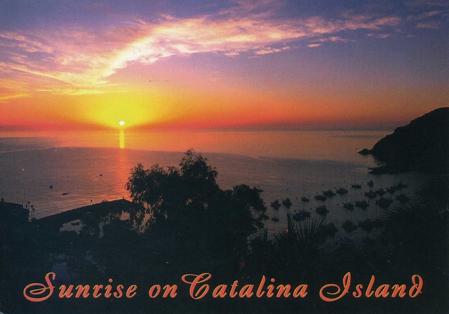
I realised I had two postcards showing Catalina Island in California, USA, so why not have them both in the same post?
The first card, above, is from a facebook swap with Abran last year, while the second card below is an official I received in 2011.
US-1297946
Santa Catalina Island, often called Catalina Island, or just Catalina, is a rocky island off the coast of the U.S. state of California in the Gulf of Santa Catalina. The island is 35 km long and 13 km across at its greatest width. The island is located about 35 km south-southwest of Los Angeles, California. The highest point on the island is 639m Mt. Orizaba. One of the Channel Islands of California archipelago, Catalina lies within Los Angeles County.
Catalina was originally settled by Native Americans who called the island Pimugna or Pimu and referred to themselves as Pimugnans or Pimuvit. The first Europeans to arrive on Catalina claimed it for the Spanish Empire. Over the years, territorial claims to the island transferred to Mexico and then to the United States. During this time, the island was sporadically used for smuggling, otter hunting, and gold-digging, before successfully being developed into a tourist destination by chewing gum magnate William Wrigley, Jr. beginning in the 1920s. Since the 1970s, most of the island has been administered by the Catalina Island Conservancy.
The total population as of the 2010 census was 4,096 persons, 90 percent of whom live in the island's only incorporated city, Avalon. The second center of population is the unincorporated village of Two Harbors at the island's isthmus. Development occurs also at the smaller settlements of Rancho Escondido and Middle Ranch. The remaining population is scattered over the island between the two population centers.
The postcard I received in 2012 has a printed postage label so I'm only showing the stamps on the official card. I love the dog stamps!
The first card, above, is from a facebook swap with Abran last year, while the second card below is an official I received in 2011.
Santa Catalina Island, often called Catalina Island, or just Catalina, is a rocky island off the coast of the U.S. state of California in the Gulf of Santa Catalina. The island is 35 km long and 13 km across at its greatest width. The island is located about 35 km south-southwest of Los Angeles, California. The highest point on the island is 639m Mt. Orizaba. One of the Channel Islands of California archipelago, Catalina lies within Los Angeles County.
Catalina was originally settled by Native Americans who called the island Pimugna or Pimu and referred to themselves as Pimugnans or Pimuvit. The first Europeans to arrive on Catalina claimed it for the Spanish Empire. Over the years, territorial claims to the island transferred to Mexico and then to the United States. During this time, the island was sporadically used for smuggling, otter hunting, and gold-digging, before successfully being developed into a tourist destination by chewing gum magnate William Wrigley, Jr. beginning in the 1920s. Since the 1970s, most of the island has been administered by the Catalina Island Conservancy.
The total population as of the 2010 census was 4,096 persons, 90 percent of whom live in the island's only incorporated city, Avalon. The second center of population is the unincorporated village of Two Harbors at the island's isthmus. Development occurs also at the smaller settlements of Rancho Escondido and Middle Ranch. The remaining population is scattered over the island between the two population centers.
The postcard I received in 2012 has a printed postage label so I'm only showing the stamps on the official card. I love the dog stamps!
Labels:
2011,
2012,
california,
catalina island,
facebook,
officials,
usa
Saturday, 22 December 2012
Christchurch, New Zealand
I've got a pretty random selection of cards for today.. next up is this one from New Zealand.
Christchurch is the largest city in the South Island of New Zealand, and the country's third-largest urban area. It lies one third of the way down the South Island's east coast, just north of Banks Peninsula which itself, since 2006, lies within the formal limits of Christchurch. On this postcard you can see one of Christchurch's tramcars travelling the city loop route, passing by the Christchurch Arts Centre. The Arts Centre is one of the many buildings that suffered extensive damage in the 22 February 2011 earthquake.
Saturday, 20 October 2012
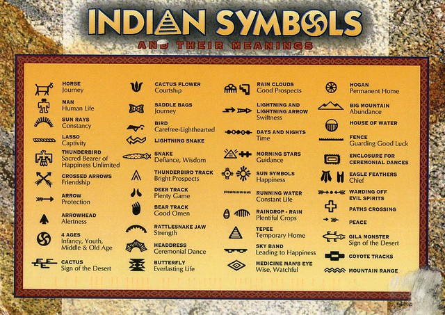
American Indian symbols
A fantastic official card I received from the USA last year. I find this really interesting!
US-1346923
Info from the back of the card:
The earliest writings of the American Indians were those of signs and symbols. These symbols are always apparent in their handicraft and jewellery.
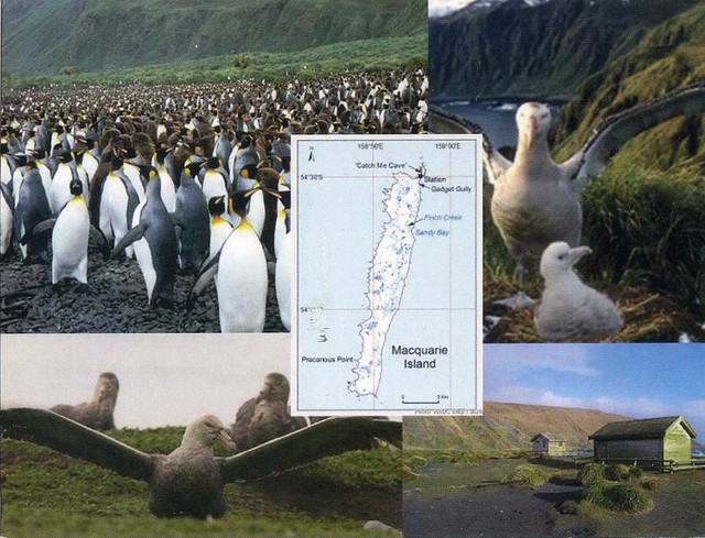
Macquarie Island, Australian Antarctic Territories
This lovely Australian Unesco card was sent to me last year by my postcard pal Sharon. She's sent me some real gems before, including this one. ;)
Macquarie Island lies in the southwest corner of the Pacific Ocean, about half-way between New Zealand and Antarctica, at 54°30S, 158°57E. Politically, it is part of Tasmania, Australia since 1900 and became a Tasmanian State Reserve in 1978. In 1997 it became a World Heritage Site. It was a part of Esperance Municipality until 1993, when the municipality was merged with other municipalities to Huon Valley. The island is home to the entire Royal Penguin population on earth during their annual nesting season. Ecologically, it is part of the Antipodes Subantarctic Islands tundra ecoregion.
Since 1948 the Australian Antarctic Division (AAD) has maintained a permanent base, the Macquarie Island Station, on the isthmus at the northern end of the island at the foot of Wireless Hill. The population of the base, the island's only human inhabitants, usually varies from 20 to 40 people over the year.
Macquarie Island lies in the southwest corner of the Pacific Ocean, about half-way between New Zealand and Antarctica, at 54°30S, 158°57E. Politically, it is part of Tasmania, Australia since 1900 and became a Tasmanian State Reserve in 1978. In 1997 it became a World Heritage Site. It was a part of Esperance Municipality until 1993, when the municipality was merged with other municipalities to Huon Valley. The island is home to the entire Royal Penguin population on earth during their annual nesting season. Ecologically, it is part of the Antipodes Subantarctic Islands tundra ecoregion.
Since 1948 the Australian Antarctic Division (AAD) has maintained a permanent base, the Macquarie Island Station, on the isthmus at the northern end of the island at the foot of Wireless Hill. The population of the base, the island's only human inhabitants, usually varies from 20 to 40 people over the year.
Labels:
2011,
animals,
australia,
australian antarctic territory,
friends,
macquarie island,
unesco
Sunday, 16 September 2012
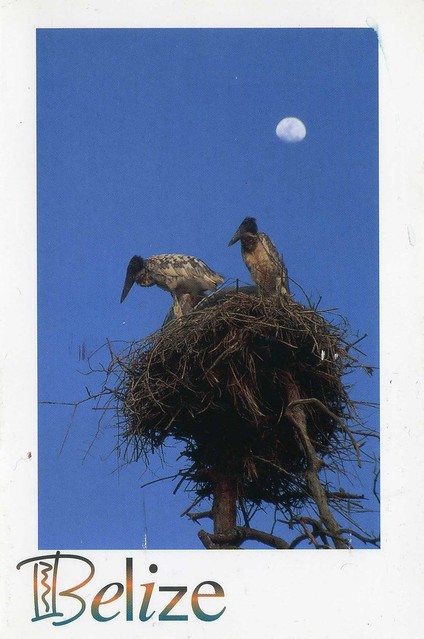
Jabiru stork, Belize
A lovely postcard from Belize I received last year. This was actually my first received written and stamped postcard from Belize, too! Thank you so much, Debbie!
Jabiru stork (Jabiru mycteria). Standing nearly five feet tall and with a 9-12 foot wingspan, the jabiru is the largest stork in Americas.
Saturday, 15 September 2012
Uros islands, Lake Titicaca, Peru
Another postcard from South America, this time from Peru, thanks to dear Jane.
These are the Uros islands, on Lake Titicaca, located between Peru and Bolivia. The islands were built by the Uros people, hence the name, and are inhabited by them to date. They are constructed of reeds, which the Uros people also use to build their homes and boats.
The islands float, and can be moved if necessary (they were originally build like this in case they came under attack).
These are the Uros islands, on Lake Titicaca, located between Peru and Bolivia. The islands were built by the Uros people, hence the name, and are inhabited by them to date. They are constructed of reeds, which the Uros people also use to build their homes and boats.
The islands float, and can be moved if necessary (they were originally build like this in case they came under attack).
Avenida 9 de Julio, Buenos Aires, Argentina
I *still* haven't received any officials from Argentina, but at least I have some postcards from there thanks to swaps, like this one I received last year.
Avenida 9 de Julio is the widest avenue in the world. It is located in the city of Buenos Aires, Argentina. Its name honors Argentina's Independence Day, July 9, 1816.
The avenue runs roughly 1 kilometre to the west of the Río de la Plata waterfront, from the Retiro district in the north to Constitución station in the south. The avenue has up to seven lanes in each direction and is flanked on either side by parallel streets of two lanes each.
Avenida 9 de Julio is the widest avenue in the world. It is located in the city of Buenos Aires, Argentina. Its name honors Argentina's Independence Day, July 9, 1816.
The avenue runs roughly 1 kilometre to the west of the Río de la Plata waterfront, from the Retiro district in the north to Constitución station in the south. The avenue has up to seven lanes in each direction and is flanked on either side by parallel streets of two lanes each.
Monday, 3 September 2012
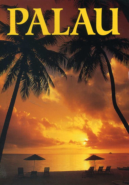
Palau
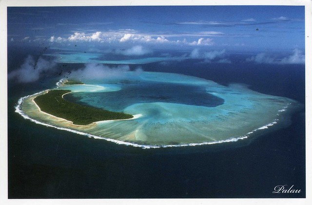
I'll finish off today with a new country to my collection: Palau. Well, actually it's not entirely new as I received a card of the place last year, but that one was mailed from Taiwan. This year I managed to receive a written and stamped postcard directly from Palau :) I'm posting both cards here as I think they complement each other, and the second one shows a better view of one of the islands.
Palau is an island country located in the western Pacific Ocean. Geographically part of the larger island group of Micronesia, with the country's population of around 21,000 people spread out over 250 islands forming the western chain of the Caroline Islands. The islands share maritime boundaries with Indonesia, the Philippines, and the Federated States of Micronesia. The most populous island in the group is Koror, with the capital city, Ngerulmud, located on nearby Babeldaob.
The card above is the one I received this year and which was mailed from Palau. The one underneath is from a swap with the wonderful Kim in Taiwan.
Palau is an island country located in the western Pacific Ocean. Geographically part of the larger island group of Micronesia, with the country's population of around 21,000 people spread out over 250 islands forming the western chain of the Caroline Islands. The islands share maritime boundaries with Indonesia, the Philippines, and the Federated States of Micronesia. The most populous island in the group is Koror, with the capital city, Ngerulmud, located on nearby Babeldaob.
The card above is the one I received this year and which was mailed from Palau. The one underneath is from a swap with the wonderful Kim in Taiwan.
Wednesday, 20 June 2012
Bangkok, Thailand
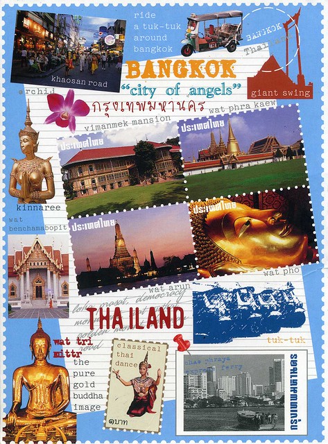
This postcard is very special to me. It was sent to me and Matt by our friend Panithan, who used to study in Wolverhampton when I was an exchange student there as well, and she was a member of the same university Aikido club as me and Matt. She's since had to move back home to Thailand. I miss her so much :( If I had more money I'd love to go visit her. Maybe one day...
Bangkok is the capital city of and largest urban area in Thailand. It is known in Thai as Krung Thep Maha Nakhon or simply Krung Thep, meaning "city of angels". Bangkok is by far the most densely populated city in Thailand with about 12 million people. Bangkok was a small trading post near the mouth of the Chao Phraya River during the Ayutthaya Kingdom in the 15th century. It eventually grew in size and became the site of two capital cities: Thonburi in 1768 and Rattanakosin in 1782.
Because of its strategic location in Southeast Asia, Siam (later Thailand) acted as a buffer-zone between the French and British colonial empires. Bangkok itself has gained a reputation as an independent, dynamic and influential city. Bangkok is the political, social and economic centre of Thailand, and one of the leading cities in Southeast Asia.
Due to the 1980s and 1990s Asian investment boom, many multinational corporations make their regional headquarters in Bangkok and the city is a regional force in finance and business. Its increasing influence on global politics, culture, fashion and entertainment underlines its status as an Alpha global city. In 2009, it was the second most expensive city in South-East Asia behind Singapore. The city's many cultural landmarks and attractions in addition to its nightlife venues has made it synonymous with exoticism. Its rapid modernization, reflected in the cityscape and the urban society, has left untouched the historic Grand Palace, Wat Arun, Vimanmek Palace Complex and hundreds of Buddhist temples draw about 10 million international visitors each year, second only to London.
Bangkok is the capital city of and largest urban area in Thailand. It is known in Thai as Krung Thep Maha Nakhon or simply Krung Thep, meaning "city of angels". Bangkok is by far the most densely populated city in Thailand with about 12 million people. Bangkok was a small trading post near the mouth of the Chao Phraya River during the Ayutthaya Kingdom in the 15th century. It eventually grew in size and became the site of two capital cities: Thonburi in 1768 and Rattanakosin in 1782.
Because of its strategic location in Southeast Asia, Siam (later Thailand) acted as a buffer-zone between the French and British colonial empires. Bangkok itself has gained a reputation as an independent, dynamic and influential city. Bangkok is the political, social and economic centre of Thailand, and one of the leading cities in Southeast Asia.
Due to the 1980s and 1990s Asian investment boom, many multinational corporations make their regional headquarters in Bangkok and the city is a regional force in finance and business. Its increasing influence on global politics, culture, fashion and entertainment underlines its status as an Alpha global city. In 2009, it was the second most expensive city in South-East Asia behind Singapore. The city's many cultural landmarks and attractions in addition to its nightlife venues has made it synonymous with exoticism. Its rapid modernization, reflected in the cityscape and the urban society, has left untouched the historic Grand Palace, Wat Arun, Vimanmek Palace Complex and hundreds of Buddhist temples draw about 10 million international visitors each year, second only to London.
Valparaiso, Chile
This beautiful view from Chile is from a swap with dear Daniela last year. Valparaiso is a Unesco site, and to me it looks totally fascinating, so beautiful and colourful!

Valparaíso is a city and commune of Chile, center of its third largest conurbation (Greater Valparaíso) and one of the country's most important seaports; it is an increasingly important cultural center in the Southwest Pacific hemisphere. The city is the capital of the Valparaíso Province and the Valparaíso Region. Although Santiago is Chile's official capital, the National Congress of Chile was established in Valparaíso in 1990.
Valparaíso played an important geopolitical role in the second half of the 19th century, when the city served as a major stopover for ships traveling between the Atlantic and Pacific oceans by crossing the Straits of Magellan. Always a magnet for European immigrants, Valparaíso mushroomed during its golden age, when the city was known by international sailors as “Little San Francisco” and “The Jewel of the Pacific.”
Examples of Valparaíso’s former glory include Latin America’s oldest stock exchange, the continent’s first volunteer fire department, Chile’s first public library, and the oldest Spanish language newspaper in continuous publication in the world. The opening of the Panama Canal and reduction in ship traffic dealt a staggering blow to Valparaíso, though the city has staged an impressive renaissance in recent years.
Though nearby San Antonio has become the country’s most commercially important seaport in terms of tonnage moved, the City of Valparaíso remains a vibrant center of Chilean culture. The Greater Valparaíso metropolitan area (which includes Valparaíso, Viña del Mar, Quilpué and Villa Alemana) has the third-largest concentration of population in the country after Greater Santiago and Greater Concepción.
Valparaíso is a city and commune of Chile, center of its third largest conurbation (Greater Valparaíso) and one of the country's most important seaports; it is an increasingly important cultural center in the Southwest Pacific hemisphere. The city is the capital of the Valparaíso Province and the Valparaíso Region. Although Santiago is Chile's official capital, the National Congress of Chile was established in Valparaíso in 1990.
Valparaíso played an important geopolitical role in the second half of the 19th century, when the city served as a major stopover for ships traveling between the Atlantic and Pacific oceans by crossing the Straits of Magellan. Always a magnet for European immigrants, Valparaíso mushroomed during its golden age, when the city was known by international sailors as “Little San Francisco” and “The Jewel of the Pacific.”
Examples of Valparaíso’s former glory include Latin America’s oldest stock exchange, the continent’s first volunteer fire department, Chile’s first public library, and the oldest Spanish language newspaper in continuous publication in the world. The opening of the Panama Canal and reduction in ship traffic dealt a staggering blow to Valparaíso, though the city has staged an impressive renaissance in recent years.
Though nearby San Antonio has become the country’s most commercially important seaport in terms of tonnage moved, the City of Valparaíso remains a vibrant center of Chilean culture. The Greater Valparaíso metropolitan area (which includes Valparaíso, Viña del Mar, Quilpué and Villa Alemana) has the third-largest concentration of population in the country after Greater Santiago and Greater Concepción.
Thursday, 14 June 2012
Batan Island, the Philippines
A lovely lighthouse view I received from dear Maerose last year. I really like that car, too, it's so colourful!
Batan island is the main island of the Batanes Province in the northern Philippines, part of the Batanes Islands group and the Luzon Volcanic Arc. It is home to the provincial capital Basco. The island is known chiefly for Mount Iraya. This lighthouse is located in Naidi Hills. Aside from serving as a lighthouse to navigators, fishermen, seafarers and other travellers, this structure which is equivalent in height to a 6 storey building is also a tourist attraction. Its viewing deck at the 5th level is the perfect location for viewing the whole Batanes Island.
Hoi An market, Vietnam
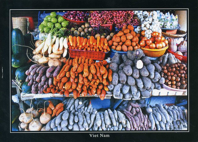
Another market view, this time from Vietnam, sent by dear Jo. I absolutely adore this postcard, it's so colourful and full of details, and the vegetables look so yummy!

I have no idea what some of these vegetables are, but I'd guess it includes at least carrots, sweet potatoe, yam, onions, garlic, some sort of melon, pumpkin.. and possibly daikon and turnip? Help, anyone? I'd love to try the small onions on the top, and I'd guess that garlic (and all the veggies as well) is a lot fresher than what I normally get in supermarkets here. Super fresh ginger is also something I'd love here, mmmmm...!
Thursday, 31 May 2012
Orchid, Venezuela
Let's stay in South America for now.. moving up further north, this postcard is one of the few cards I have received from Venezuela. Orchid is the national flower and natural emblem of Venezuela and the one here looks particularly beautiful (purple is one of my favourite colours, too!).
The Orchidaceae or orchid family is a diverse and widespread family of flowering plants with colorful and fragrant blooms. Along with the Asteraceae, it is one of the two largest families of flowering plants, with between 21,950 and 26,049 currently accepted species, found in 880 genera. Selecting which of the two families is larger remains elusive because of the difficulties associated with putting hard species numbers on such enormous groups. Regardless, the number of orchid species equals more than twice the number of bird species, and about four times the number of mammal species. It also encompasses about 6–11% of all seed plants. The largest genera are Bulbophyllum (2,000 species), Epidendrum (1,500 species), Dendrobium (1,400 species) and Pleurothallis (1,000 species).
The family also includes Vanilla (the genus of the vanilla plant), Orchis (type genus), and many commonly cultivated plants such as Phalaenopsis and Cattleya (the one shown here, unless I'm very much mistaken). Moreover, since the introduction of tropical species in the 19th century, horticulturists have produced more than 100,000 hybrids and cultivars.
The Orchidaceae or orchid family is a diverse and widespread family of flowering plants with colorful and fragrant blooms. Along with the Asteraceae, it is one of the two largest families of flowering plants, with between 21,950 and 26,049 currently accepted species, found in 880 genera. Selecting which of the two families is larger remains elusive because of the difficulties associated with putting hard species numbers on such enormous groups. Regardless, the number of orchid species equals more than twice the number of bird species, and about four times the number of mammal species. It also encompasses about 6–11% of all seed plants. The largest genera are Bulbophyllum (2,000 species), Epidendrum (1,500 species), Dendrobium (1,400 species) and Pleurothallis (1,000 species).
The family also includes Vanilla (the genus of the vanilla plant), Orchis (type genus), and many commonly cultivated plants such as Phalaenopsis and Cattleya (the one shown here, unless I'm very much mistaken). Moreover, since the introduction of tropical species in the 19th century, horticulturists have produced more than 100,000 hybrids and cultivars.
Subscribe to:
Posts (Atom)


Maroon